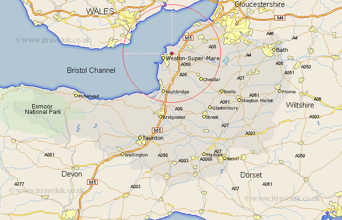
Somerset Map Showing Location of Worle
Easting: 335033 Northing: 163539
Latitude: 51.37 Longitude: -2.93
 = Worle
Latitude: 51.37 Longitude: -2.93
= Worle
This Worle map below is supplied by Google. Use the tools in the top left corner to zoom into street level or zoom out for a road map, you may also need to zoom in to see Worle on the map. Click and drag the map to move around. If the map fails to load try and refresh your browser or zoom in or out (+ or -).
Update - it seems Google no longer allow people to use their maps for free! This Worle map sometimes loads and sometimes gives a error. I am working on a solution.
Closest 30 Towns or Cities to Worle (Population over 500)
Wick St. Lawrence 2.18km Wick Saint Lawrence 2.18km Wick St Lawrence 2.18km Weston-Super-Mare 3.94km Locking 5.08km Hutton 5.56km Banwell 7.24km Bleadon 7.51km Sandford 7.88km Yatton 8.3km Congresbury 9.26km Lympsham 9.35km Clevedon 9.39km Churchill 9.98km Brean 10.93km Wrington 11.57km Shipham 11.87km Berrow 12.54km Axbridge 13.11km Weare 13.11km Brent Knoll 13.18km Nailsea 13.73km Weston 14.46km Weston Down 14.46km Weston in Gordano 14.46km Blagdon 15.5km Burnham-on-Sea 15.54km Burnham 15.54km Burnham on Sea 15.54km Portishead 16.04km