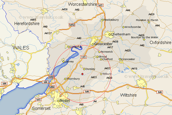
Gloucestershire Map Showing Location of Wotton Under Edge
Population: 5251
Area Size (ha): 113
District: Stroud
Easting: 375778 Northing: 192834
Latitude: 51.63 Longitude: -2.35
 = Wotton Under Edge
Area Size (ha): 113
District: Stroud
Easting: 375778 Northing: 192834
Latitude: 51.63 Longitude: -2.35
= Wotton Under Edge
This Wotton Under Edge map below is supplied by Google. Use the tools in the top left corner to zoom into street level or zoom out for a road map, you may also need to zoom in to see Wotton Under Edge on the map. Click and drag the map to move around. If the map fails to load try and refresh your browser or zoom in or out (+ or -).
Update - it seems Google no longer allow people to use their maps for free! This Wotton Under Edge map sometimes loads and sometimes gives a error. I am working on a solution.
Closest 30 Towns or Cities to Wotton Under Edge (Population over 500)
Dursley 3.88km North Nibley 4.36km Charfield 4.96km Hawkesbury 5.68km Uley 6.01km Wickwar 6.02km Falfield 6.9km Cromhall 7.15km Cam 7.41km Stone 8.26km Berkeley 8.86km Coaley 9.34km Slimbridge 9.55km Horsley 9.78km Tytherington 9.92km Rangeworthy 10.13km Chipping Sodbury 11.36km Nailsworth 11.74km Thornbury 12.09km Woodchester 12.27km Iron Acton 12.28km Tetbury 12.65km Alveston 13.19km Stonehouse 13.76km Avening 13.81km Westerleigh 14.19km Frampton Cotterell 14.44km Winterbourne 14.58km Minchinhampton 14.66km Frampton-on-Severn 14.87km