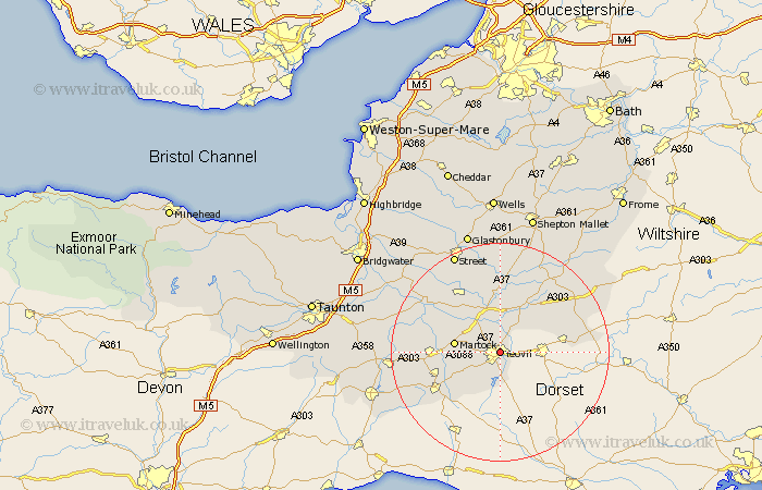
Somerset Map Showing Location of Yeovil
Population: 38217
Area Size (ha): 1135
District: South Somerset
Easting: 355516 Northing: 116981
Latitude: 50.95 Longitude: -2.63
 = Yeovil
Area Size (ha): 1135
District: South Somerset
Easting: 355516 Northing: 116981
Latitude: 50.95 Longitude: -2.63
= Yeovil
This Yeovil map below is supplied by Google. Use the tools in the top left corner to zoom into street level or zoom out for a road map, you may also need to zoom in to see Yeovil on the map. Click and drag the map to move around. If the map fails to load try and refresh your browser or zoom in or out (+ or -).
Update - it seems Google no longer allow people to use their maps for free! This Yeovil map sometimes loads and sometimes gives a error. I am working on a solution.
Closest 30 Towns or Cities to Yeovil (Population over 500)
Yeovil 0km Mudford 3.88km West Coker 5.1km Montacute 5.84km Yeovilton 6.03km Tintinhull 6.13km Ilchester 6.57km Queen Camel 8.2km Martock 8.38km West Chinnock 8.98km Haselbury Plucknett 9.89km Sparkford 10.37km South Petherton 11.68km Milborne Port 11.82km Long Sutton 11.92km Kingsbury Episcopi 12.25km Kingsbury 12.25km North Cadbury 12.35km Charlton Mackrell 13.18km Somerton 13.8km Crewkerne 13.84km Misterton 14.91km Henstridge 16.45km Barton Saint David 16.72km Barton St. David 16.72km Barton St David 16.72km Langport 16.79km Castle Cary 16.92km Butleigh 17.04km Compton 17.67km