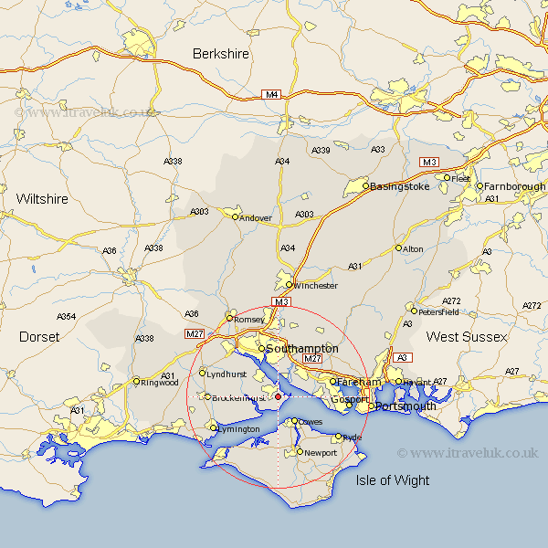
Hampshire Map Showing Location of Fawley
Population: 12840
Area Size (ha): 791
District: New Forest
Easting: 445785 Northing: 102169
Latitude: 50.82 Longitude: -1.35
 = Fawley
Area Size (ha): 791
District: New Forest
Easting: 445785 Northing: 102169
Latitude: 50.82 Longitude: -1.35
= Fawley
This Fawley map below is supplied by Google. Use the tools in the top left corner to zoom into street level or zoom out for a road map, you may also need to zoom in to see Fawley on the map. Click and drag the map to move around. If the map fails to load try and refresh your browser or zoom in or out (+ or -).
Update - it seems Google no longer allow people to use their maps for free! This Fawley map sometimes loads and sometimes gives a error. I am working on a solution.
Closest 30 Towns or Cities to Fawley (Population over 500)
Hample 4.38km Hamble 4.38km Netley Marsh 5.68km Netley 5.68km Locks Heath 5.8km Ashurst 5.96km Bursledon 6.58km Hythe 6.58km Cowes 6.58km Beaulieu 7.03km Bewley 7.03km Gurnard 7.78km Dibden 8.07km East Cowes 8.21km Marchwood 9.44km Itchen 9.55km Northwood 9.57km Lee on Solent 10.7km Lee on the Solent 10.7km Lee-on-Solent 10.7km Lee-on-the-Solent 10.7km West End 11.18km Southampton 12.01km Fareham 12.28km Botley 12.56km Curbridge 13.15km Curdridge 13.15km Eling 13.17km Shalfleet 13.44km Newport 13.8km