Kent Map Showing Location of Kingsnorth
Easting: 580705 Northing: 173739
Latitude: 51.43 Longitude: 0.6
 = Kingsnorth
Latitude: 51.43 Longitude: 0.6
= Kingsnorth
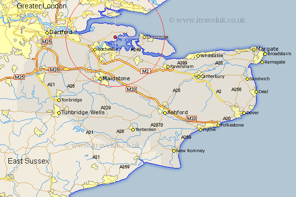
This Kingsnorth map below is supplied by Google. Use the tools in the top left corner to zoom into street level or zoom out for a road map, you may also need to zoom in to see Kingsnorth on the map. Click and drag the map to move around. If the map fails to load try and refresh your browser or zoom in or out (+ or -).
Update - it seems Google no longer allow people to use their maps for free! This Kingsnorth map sometimes loads and sometimes gives a error. I am working on a solution.
Closest 30 Towns or Cities to Kingsnorth (Population over 500)
Stoke 1.16km High Halstow 3.47km Hoo 4.37km Allhallows 5.08km Gillingham 6.14km Chatham 8.02km Upchurch 8.18km Grain 8.3km Lower Halstow 8.73km Strood 8.89km Higham 9.24km Rochester 9.63km Newington 10.35km Sheerness 11.55km Bobbing 11.57km Queenborough 11.7km Iwade 11.85km Shorne 12.14km Stockbury 13.42km Cuxton 13.93km Wouldham 14.47km Borden 14.71km Cobham 14.95km Minster 15.14km Sittingbourne 15.23km Burham 15.29km Tunstall 15.29km Gravesend 16.18km Bredgar 16.37km Detling 16.72km