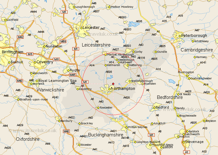
Northamptonshire Map Showing Location of Moulton
Population: 4957
Area Size (ha): 110
District: Daventry
Easting: 478439 Northing: 265683
Latitude: 52.28 Longitude: -0.85
 = Moulton
Area Size (ha): 110
District: Daventry
Easting: 478439 Northing: 265683
Latitude: 52.28 Longitude: -0.85
= Moulton
This Moulton map below is supplied by Google. Use the tools in the top left corner to zoom into street level or zoom out for a road map, you may also need to zoom in to see Moulton on the map. Click and drag the map to move around. If the map fails to load try and refresh your browser or zoom in or out (+ or -).
Update - it seems Google no longer allow people to use their maps for free! This Moulton map sometimes loads and sometimes gives a error. I am working on a solution.
Closest 30 Towns or Cities to Moulton (Population over 500)
Overstone 2.27km Pitsford 2.93km Boughton 3.4km Billing 4.34km Great Billing 4.34km Northampton 4.34km Sywell 4.54km Brixworth 5.04km Walgrave 6.01km Great Houghton 7.49km Houghton 7.49km Earls Barton 7.75km Spratton 7.75km Whiston 8.79km Wilby 9.26km Hardingstone 9.54km Wellingborough 10.37km Great Doddington 10.37km Doddington 10.37km Harpole 10.64km Kislingbury 10.86km Denton 10.86km Broughton 10.87km Wootton 11.35km Hackleton 11.35km East Haddon 11.49km Guilsborough 11.61km Collingtree 11.63km Milton 12.01km Yardley Hastings 12.2km