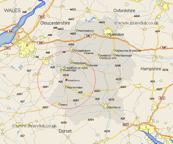
Wiltshire Map Showing Location of Westbury
Population: 11560
Area Size (ha): 400
District: West Wiltshire
Easting: 387206 Northing: 150165
Latitude: 51.25 Longitude: -2.18
 = Westbury
Area Size (ha): 400
District: West Wiltshire
Easting: 387206 Northing: 150165
Latitude: 51.25 Longitude: -2.18
= Westbury
This Westbury map below is supplied by Google. Use the tools in the top left corner to zoom into street level or zoom out for a road map, you may also need to zoom in to see Westbury on the map. Click and drag the map to move around. If the map fails to load try and refresh your browser or zoom in or out (+ or -).
Update - it seems Google no longer allow people to use their maps for free! This Westbury map sometimes loads and sometimes gives a error. I am working on a solution.
Closest 30 Towns or Cities to Westbury (Population over 500)
Westbury 0km Dilton 2.19km North Bradley 4.37km Bratton 5km Southwick 5.08km Warminster 5.56km Corsley 5.94km Edington 6.09km Steeple Ashton 6.56km Hilperton 7.42km Trowbridge 8.19km Heytesbury 8.75km Erlestoke 8.92km Bradford-on-Avon 9.33km Bradford on Avon 9.33km Longbridge Deverill 9.34km Westwood 10.17km Worton 10.99km Holt 11.18km Semington 11.36km West Lavington 12.76km Broughton Gifford 12.98km Seend 13.11km Melksham 13.43km Potterne 13.76km Limpley Stoke 13.95km Market Lavington 14.4km Lavington 14.4km Codford 14.49km Atworth 14.87km