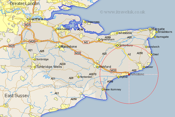
Kent Map Showing Location of Folkestone
Population: 44807
Area Size (ha): 1318
District: Shepway
Easting: 622927 Northing: 136433
Latitude: 51.08 Longitude: 1.18
 = Folkestone
Area Size (ha): 1318
District: Shepway
Easting: 622927 Northing: 136433
Latitude: 51.08 Longitude: 1.18
= Folkestone
This Folkestone map below is supplied by Google. Use the tools in the top left corner to zoom into street level or zoom out for a road map, you may also need to zoom in to see Folkestone on the map. Click and drag the map to move around. If the map fails to load try and refresh your browser or zoom in or out (+ or -).
Update - it seems Google no longer allow people to use their maps for free! This Folkestone map sometimes loads and sometimes gives a error. I am working on a solution.
Closest 30 Towns or Cities to Folkestone (Population over 500)
Hawkinge 2.19km Swingfield 5.56km Alkham 6.56km Hythe 7.23km Lyminge 7.91km River 8.05km Elham 8.76km Lydden 8.76km Temple Ewell 9.43km Ewell 9.43km Coldred 10.37km Lympne 10.64km Dover 11.65km Sibertswold 11.65km Shepherdswell 11.65km St Margaret's at Cliffe 11.9km St Margaret at Cliffe 11.9km St. Margaret at Cliffe 11.9km Saint Margaret at Cliffe 11.9km St Margarets 11.9km St. Margaret's at Cliffe 11.9km St. Margarets 11.9km Saint Margaret's at Cliffe 11.9km Saint Margarets 11.9km Sellindge 12.94km Sellinge 12.94km Eythorne 13.13km West Langdon 13.14km Langdon 13.14km Stelling 13.78km