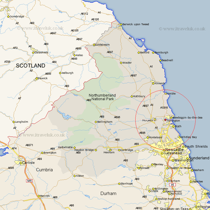
Northumberland Map Showing Location of Ashington
Population: 27857
Area Size (ha): 538
District: Wansbeck
Easting: 426347 Northing: 585592
Latitude: 55.16 Longitude: -1.59
 = Ashington
Area Size (ha): 538
District: Wansbeck
Easting: 426347 Northing: 585592
Latitude: 55.16 Longitude: -1.59
= Ashington
This Ashington map below is supplied by Google. Use the tools in the top left corner to zoom into street level or zoom out for a road map, you may also need to zoom in to see Ashington on the map. Click and drag the map to move around. If the map fails to load try and refresh your browser or zoom in or out (+ or -).
Update - it seems Google no longer allow people to use their maps for free! This Ashington map sometimes loads and sometimes gives a error. I am working on a solution.
Closest 30 Towns or Cities to Ashington (Population over 500)
Pegswood 3km Bedlington 3.49km Newbiggin-by-the-Sea 3.7km Newbiggin by the Sea 3.7km Hepscott 4.33km Ellington 6km Lynemouth 6.14km Morpeth 6.17km Hebron 6.52km Blythe 6.65km Blyth 6.65km Stannington 8.75km Dudley 9.59km Seaton Sluice 10.75km Cramlington 10.81km Seaton Delaval 11.68km Seghill 12.87km East Chevington 13.28km Longhorsley 13.8km Dinnington 14.09km Shiremoor 14.34km Killingworth 14.58km Thirston 14.63km East Thirston 14.63km Felton 15.11km Whitley Bay 15.14km Whitley 15.14km Ponteland 16.39km Woolsington 17.49km Swarland 17.77km