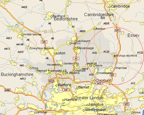
Hertfordshire Map Showing Location of Bishop's Stortford
Population: 28347
Area Size (ha): 761
District: East Hertfordshire
Easting: 549161 Northing: 220948
Latitude: 51.87 Longitude: 0.17
 = Bishop's Stortford
Area Size (ha): 761
District: East Hertfordshire
Easting: 549161 Northing: 220948
Latitude: 51.87 Longitude: 0.17
= Bishop's Stortford
This Bishop's Stortford map below is supplied by Google. Use the tools in the top left corner to zoom into street level or zoom out for a road map, you may also need to zoom in to see Bishop's Stortford on the map. Click and drag the map to move around. If the map fails to load try and refresh your browser or zoom in or out (+ or -).
Update - it seems Google no longer allow people to use their maps for free! This Bishop's Stortford map sometimes loads and sometimes gives a error. I am working on a solution.
Closest 30 Towns or Cities to Bishop's Stortford (Population over 500)
Thorley 2.18km Sawbridgeworth 5.68km Little Hadham 6.01km Much Hadham 6.02km Albury 6.81km Standon 9.34km Widford 10.72km Braughing 10.94km Hormead 13.02km Thundridge 13.13km Stanstead Abbots 13.87km Little Munden 14.88km Ware 15.62km Buntingford 15.62km Great Amwell 15.65km Little Amwell 16.58km Hoddesdon 17.31km Hertford 17.67km Barkway 18.04km Benington 18.4km Bennington 18.4km Watton at Stone 18.41km Watton 18.41km Cottered 18.68km Stapleford 18.69km Hertingfordbury 20.54km Barley 20.66km Walkern 21.32km Aston 21.82km Datchworth 21.83km