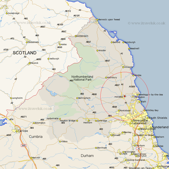
Northumberland Map Showing Location of Morpeth
Population: 14096
Area Size (ha): 372
District: Castle Morpeth
Easting: 420170 Northing: 585872
Latitude: 55.17 Longitude: -1.68
 = Morpeth
Area Size (ha): 372
District: Castle Morpeth
Easting: 420170 Northing: 585872
Latitude: 55.17 Longitude: -1.68
= Morpeth
This Morpeth map below is supplied by Google. Use the tools in the top left corner to zoom into street level or zoom out for a road map, you may also need to zoom in to see Morpeth on the map. Click and drag the map to move around. If the map fails to load try and refresh your browser or zoom in or out (+ or -).
Update - it seems Google no longer allow people to use their maps for free! This Morpeth map sometimes loads and sometimes gives a error. I am working on a solution.
Closest 30 Towns or Cities to Morpeth (Population over 500)
Hebron 1.85km Hepscott 2.82km Pegswood 3.18km Ashington 6.17km Bedlington 7.28km Stannington 7.49km Longhorsley 9.1km Ellington 9.26km Newbiggin by the Sea 9.61km Newbiggin-by-the-Sea 9.61km Lynemouth 10.32km Dudley 11.45km Blyth 11.91km Blythe 11.91km Cramlington 12.81km East Thirston 12.96km Thirston 12.96km Dinnington 12.98km Felton 13.01km Ponteland 13.65km East Chevington 14.43km Longframlington 14.43km Swarland 15.16km Seaton Delaval 15.36km Seaton Sluice 15.45km Seghill 15.5km Shiremoor 16.46km Killingworth 16.59km Woolsington 16.68km Stamfordham 18.87km