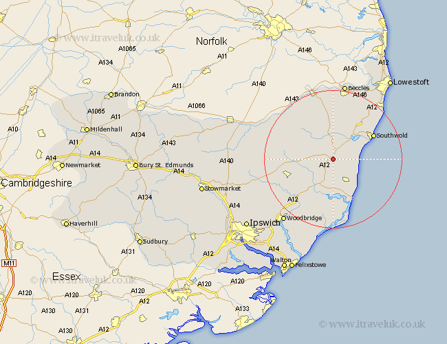
Suffolk Map Showing Location of Yoxford
Population: 695
District: Suffolk Coastal
Easting: 639923 Northing: 269041
Latitude: 52.27 Longitude: 1.52
 = Yoxford
District: Suffolk Coastal
Easting: 639923 Northing: 269041
Latitude: 52.27 Longitude: 1.52
= Yoxford
This Yoxford map below is supplied by Google. Use the tools in the top left corner to zoom into street level or zoom out for a road map, you may also need to zoom in to see Yoxford on the map. Click and drag the map to move around. If the map fails to load try and refresh your browser or zoom in or out (+ or -).
Update - it seems Google no longer allow people to use their maps for free! This Yoxford map sometimes loads and sometimes gives a error. I am working on a solution.
Closest 30 Towns or Cities to Yoxford (Population over 500)
Saxmundham 5.67km Wenhaston 6km Cookley 7.17km Holton 7.41km Leiston 8.16km Halesworth 9.33km Snape 9.34km Laxfield 10.85km Wangford 11.49km Thorpe 13.04km Thorpeness 13.04km Southwold 13.54km Framlingham 13.67km Reydon 13.78km Aldeburgh 14.16km Dennington 14.74km Tunstall 15.51km Wickham Market 16.52km Wrentham 17.22km Fressingfield 17.4km Stradbroke 17.89km Rendlesham 18.02km Worlingworth 18.15km Ufford 20.18km Orford 20.42km Worlingham 20.88km Bungay 20.88km Kessingland 21.51km Beccles 22.5km Gisleham 22.97km