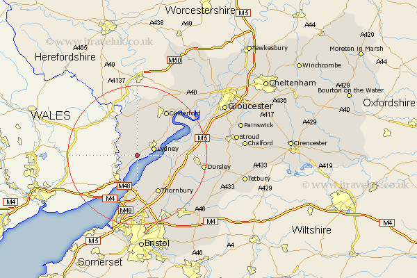
Gloucestershire Map Showing Location of Woolaston
Population: 1229
District: Forest of Dean
Easting: 358539 Northing: 200361
Latitude: 51.7 Longitude: -2.6
 = Woolaston
District: Forest of Dean
Easting: 358539 Northing: 200361
Latitude: 51.7 Longitude: -2.6
= Woolaston
This Woolaston map below is supplied by Google. Use the tools in the top left corner to zoom into street level or zoom out for a road map, you may also need to zoom in to see Woolaston on the map. Click and drag the map to move around. If the map fails to load try and refresh your browser or zoom in or out (+ or -).
Update - it seems Google no longer allow people to use their maps for free! This Woolaston map sometimes loads and sometimes gives a error. I am working on a solution.
Closest 30 Towns or Cities to Woolaston (Population over 500)
Woolaston 0km Lydney 4.95km Bream 6.01km Tidenham 6.54km St. Briavels 6.83km St Briavels 6.83km Saint Briavels 6.83km Newland 9.88km Berkeley 10.5km Stone 10.74km Coleford 11.12km Aust 11.18km Alveston 12.03km Thornbury 12.52km Falfield 12.73km Olveston 13.18km Staunton 13.42km Awre 13.67km Tytherington 13.73km Cromhall 13.89km Slimbridge 15.04km Cinderford 15.26km North Nibley 15.39km Charfield 15.68km Newnham 15.98km Newham 15.98km Lydbrook 16.72km Almondsbury 16.84km Pilning 16.84km Cam 17.23km