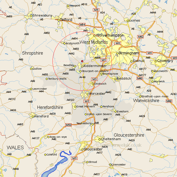
Worcestershire Map Showing Location of Wolverley
District: Wyre Forest
Easting: 382998 Northing: 279927
Latitude: 52.42 Longitude: -2.25
 = Wolverley
Easting: 382998 Northing: 279927
Latitude: 52.42 Longitude: -2.25
= Wolverley
This Wolverley map below is supplied by Google. Use the tools in the top left corner to zoom into street level or zoom out for a road map, you may also need to zoom in to see Wolverley on the map. Click and drag the map to move around. If the map fails to load try and refresh your browser or zoom in or out (+ or -).
Update - it seems Google no longer allow people to use their maps for free! This Wolverley map sometimes loads and sometimes gives a error. I am working on a solution.
Closest 30 Towns or Cities to Wolverley (Population over 500)
Kidderminster 3.71km Churchill 4.52km Bewdley 5.85km Stone 6.51km Arley 7.03km Upper Arley 7.03km Stourport 7.5km Stourport-on-Severn 7.5km Stourport on Severn 7.5km Clent 9.04km Hagley 9.23km Belbroughton 9.23km Chaddesley Corbett 9.33km Hartlebury 9.34km Stourbridge 9.67km Dodford 12.6km Great Dodford 12.6km Netherton 13.51km Romsley 13.56km Astley 13.74km Rock 13.77km Halesowen 14.06km Lickey End 14.67km Lickey 14.67km Abberley 15.2km Bromsgrove 15.52km Great Witley 16.32km Ombersley 16.72km Stoke Prior 17.98km Droitwich 18.01km