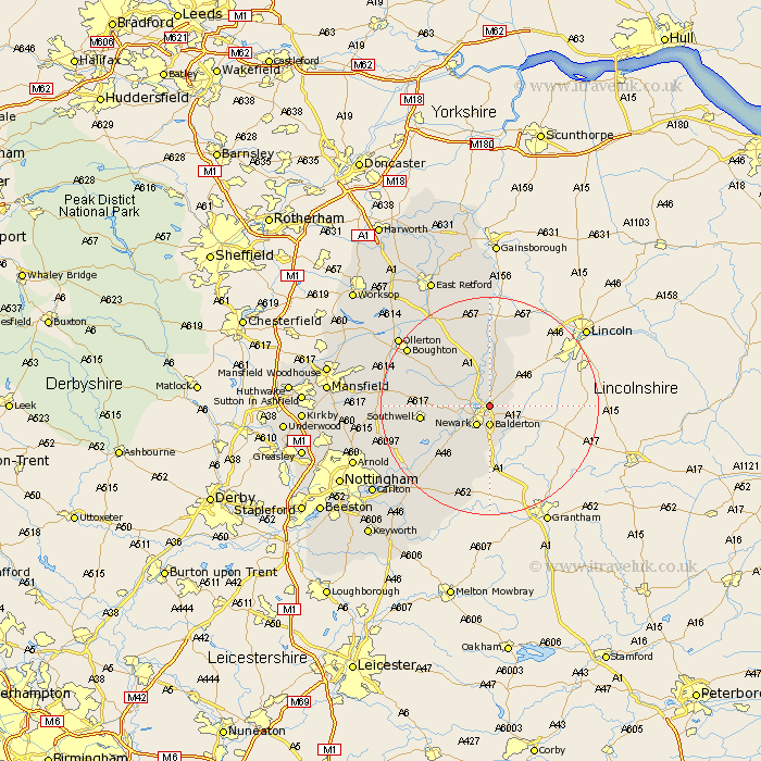
Nottinghamshire Map Showing Location of Winthorpe
Population: 657
District: Newark and Sherwood
Easting: 481452 Northing: 356591
Latitude: 53.1 Longitude: -0.78
 = Winthorpe
District: Newark and Sherwood
Easting: 481452 Northing: 356591
Latitude: 53.1 Longitude: -0.78
= Winthorpe
This Winthorpe map below is supplied by Google. Use the tools in the top left corner to zoom into street level or zoom out for a road map, you may also need to zoom in to see Winthorpe on the map. Click and drag the map to move around. If the map fails to load try and refresh your browser or zoom in or out (+ or -).
Update - it seems Google no longer allow people to use their maps for free! This Winthorpe map sometimes loads and sometimes gives a error. I am working on a solution.
Closest 30 Towns or Cities to Winthorpe (Population over 500)
North Muskham 2.9km Muskham 2.9km Coddington 2.9km Balderton 3.7km Newark 4.32km Newark-on-Trent 4.32km Newark on Trent 4.32km Newark upon Trent 4.32km North Collingham 5.99km Collingham 5.99km Farndon 7.12km Fiskerton 9.57km Fiskerton Ferry 9.57km Elston 10.81km Southwell 12.01km Bleasby 12.47km Tuxford 14.59km Flintham 15.14km Farnsfield 16.69km Bilsthorpe 17.09km Boughton 17.88km East Markham 17.96km Markham 17.96km East Bridgford 18.54km Aslocton 19.71km Aslockton 19.71km Oxton 19.73km Walesby 19.94km Ollerton 20.26km Edwinstowe 21.05km