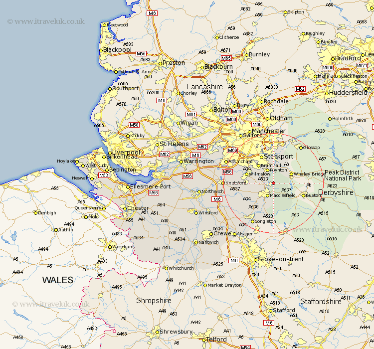
Cheshire Map Showing Location of Bollington
Population: 6582
Area Size (ha): 176
District: Macclesfield
Easting: 394447 Northing: 378150
Latitude: 53.3 Longitude: -2.08
 = Bollington
Area Size (ha): 176
District: Macclesfield
Easting: 394447 Northing: 378150
Latitude: 53.3 Longitude: -2.08
= Bollington
This Bollington map below is supplied by Google. Use the tools in the top left corner to zoom into street level or zoom out for a road map, you may also need to zoom in to see Bollington on the map. Click and drag the map to move around. If the map fails to load try and refresh your browser or zoom in or out (+ or -).
Update - it seems Google no longer allow people to use their maps for free! This Bollington map sometimes loads and sometimes gives a error. I am working on a solution.
Closest 30 Towns or Cities to Bollington (Population over 500)
Bollington 0km Rainow 2.16km Adlington 3.81km Prestburg 4.81km Prestbury 4.81km Poynton 5.98km Macclesfield 5.99km Disley 7.5km Bramhall 9.25km Hazel Grove 9.52km Alderley Edge 9.97km Nether Alderley 10.14km Alderley 10.14km Wilmslow 10.63km Gawsworth 10.8km Marple 11.17km Stockport 11.97km Chelford 12.74km Romiley 12.98km Bredbury 13.16km Cheadle 14.21km Mobberley 15.61km Hyde 16.68km Goostrey 18.21km Congleton 18.4km Peover 18.58km Peover Superior 18.58km Knutsford 18.83km Longdendale 19.34km Sale 19.37km