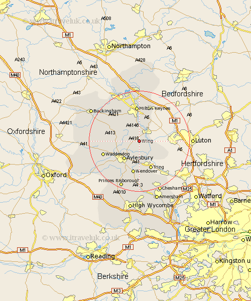
Buckinghamshire Map Showing Location of Wing
Population: 2740
Area Size (ha): 49
District: Aylesbury Vale
Easting: 488320 Northing: 221353
Latitude: 51.88 Longitude: -0.72
 = Wing
Area Size (ha): 49
District: Aylesbury Vale
Easting: 488320 Northing: 221353
Latitude: 51.88 Longitude: -0.72
= Wing
This Wing map below is supplied by Google. Use the tools in the top left corner to zoom into street level or zoom out for a road map, you may also need to zoom in to see Wing on the map. Click and drag the map to move around. If the map fails to load try and refresh your browser or zoom in or out (+ or -).
Update - it seems Google no longer allow people to use their maps for free! This Wing map sometimes loads and sometimes gives a error. I am working on a solution.
Closest 30 Towns or Cities to Wing (Population over 500)
Stewkley 4.36km Soulbury 5.56km Slapton 6.01km Cheddington 6.53km Stoke Hammond 7.42km Great Brickhill 7.76km Whitechurch 8.01km Whitchurch 8.01km Marsworth 8.16km Mursley 8.83km Ivinghoe 8.84km Buckland 9.26km Aston Clinton 9.26km Aylesbury 9.36km Edlesborough 9.87km Newton Longville 9.89km Pitstone 10.1km North Marston 10.3km Bletchley 11.18km Halton 11.18km Weston Turville 11.35km Bow Brickhill 11.64km Stoke Mandeville 12.03km Winslow 12.68km Stone 13.03km Wendover 13.17km Shenley Brook End 13.42km Great Horwood 13.85km Quainton 13.85km Milton Keynes 14.15km