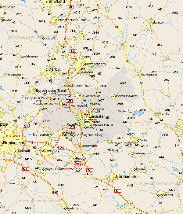
Leicestershire Map Showing Location of Wigston
Population: 30
District: Blaby
Easting: 446381 Northing: 289382
Latitude: 52.5 Longitude: -1.32
 = Wigston
District: Blaby
Easting: 446381 Northing: 289382
Latitude: 52.5 Longitude: -1.32
= Wigston
This Wigston map below is supplied by Google. Use the tools in the top left corner to zoom into street level or zoom out for a road map, you may also need to zoom in to see Wigston on the map. Click and drag the map to move around. If the map fails to load try and refresh your browser or zoom in or out (+ or -).
Update - it seems Google no longer allow people to use their maps for free! This Wigston map sometimes loads and sometimes gives a error. I am working on a solution.
Closest 30 Towns or Cities to Wigston (Population over 500)
Burbage 2.92km Sharnford 2.92km Sapcote 3.86km Little Claybrooke 3.86km Claybrooke Parva 3.86km Claybrooke 3.86km Hinckley 5.01km Stoney Stanton 5.02km Elmesthorpe 5.67km Elmsthorpe 5.67km Ullesthorpe 5.84km Broughton Astley 7.02km Croft 7.92km Stoke Golding 9.31km Higham-on-the-Hill 9.65km Higham on the Hill 9.65km Lutterworth 9.66km Cosby 10.6km Narborough 10.83km Whetstone 11.68km Gilmarton 11.88km Gilmorton 11.88km Enderby 12.17km Newbold Verdon 13.03km Desford 13.17km Blaby 13.49km Countesthorpe 13.59km Walton 14.04km Walton-in-Knaptoft 14.04km Market Bosworth 14.15km