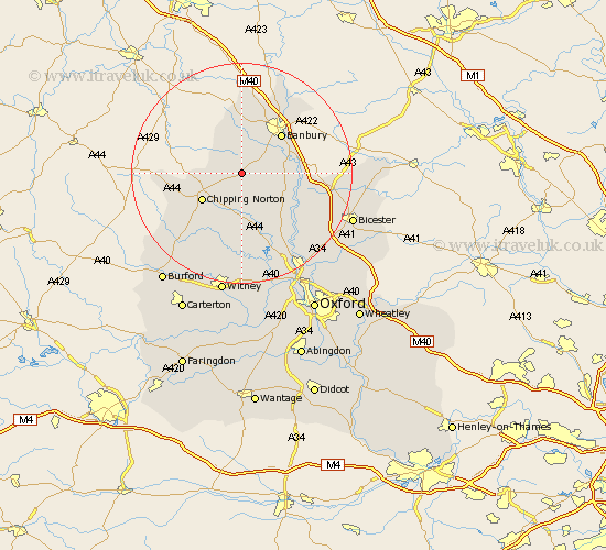
Oxfordshire Map Showing Location of Wigginton
Population: 192
District: Cherwell
Easting: 438912 Northing: 231848
Latitude: 51.98 Longitude: -1.43
 = Wigginton
District: Cherwell
Easting: 438912 Northing: 231848
Latitude: 51.98 Longitude: -1.43
= Wigginton
This Wigginton map below is supplied by Google. Use the tools in the top left corner to zoom into street level or zoom out for a road map, you may also need to zoom in to see Wigginton on the map. Click and drag the map to move around. If the map fails to load try and refresh your browser or zoom in or out (+ or -).
Update - it seems Google no longer allow people to use their maps for free! This Wigginton map sometimes loads and sometimes gives a error. I am working on a solution.
Closest 30 Towns or Cities to Wigginton (Population over 500)
Hook Norton 3.42km Barford St John 4.57km Barford St. John 4.57km Barford 4.57km Barford Saint John 4.57km Bloxham 4.93km Enstone 7.49km Deddington 7.99km Adderbury 8.2km Chipping Norton 8.59km Duns Tew 8.82km Wroxton 9.55km Banbury 10.09km Steeple Aston 11.76km Chadlington 12.5km Barton 12.56km Upper Heyford 12.7km Charlbury 13.17km Churchill 13.84km Fritwell 14.19km Cropredy 15.23km Tackley 15.24km Kingham 15.61km Ardley 15.85km Wardington 16.54km Stonesfield 16.68km Woodstock 16.84km Kirtlington 17.28km Shipton under Wychwood 18.04km Shipton 18.04km