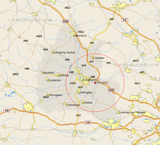
Oxfordshire Map Showing Location of Wheatley
Population: 3634
Area Size (ha): 110
District: South Oxfordshire
Easting: 459844 Northing: 204249
Latitude: 51.73 Longitude: -1.13
 = Wheatley
Area Size (ha): 110
District: South Oxfordshire
Easting: 459844 Northing: 204249
Latitude: 51.73 Longitude: -1.13
= Wheatley
This Wheatley map below is supplied by Google. Use the tools in the top left corner to zoom into street level or zoom out for a road map, you may also need to zoom in to see Wheatley on the map. Click and drag the map to move around. If the map fails to load try and refresh your browser or zoom in or out (+ or -).
Update - it seems Google no longer allow people to use their maps for free! This Wheatley map sometimes loads and sometimes gives a error. I am working on a solution.
Closest 30 Towns or Cities to Wheatley (Population over 500)
Cuddesdon 1.85km Garsington 3.88km Great Milton 3.91km Milton 3.91km Tiddington 4.59km Great Haseley 5.9km Littlemore 6.03km Beckley 6.54km Stadhampton 7.41km Oxford 8.25km Radley 8.85km Drayton 9.26km Drayton Saint Leonard 9.26km Drayton St. Leonard 9.26km Drayton St Leonard 9.26km Chalgrove 9.88km Tetsworth 9.9km North Hinksey 10.33km Clifton Hampden 10.34km Thame 10.49km Benson 11.18km Dorchester 11.36km Islip 11.55km Sunningwell 11.74km Wootton 12.06km Abingdon-on-Thames 12.72km Abingdon 12.72km Abingdon on Thames 12.72km Warborough 12.97km Ambrosden 13.03km