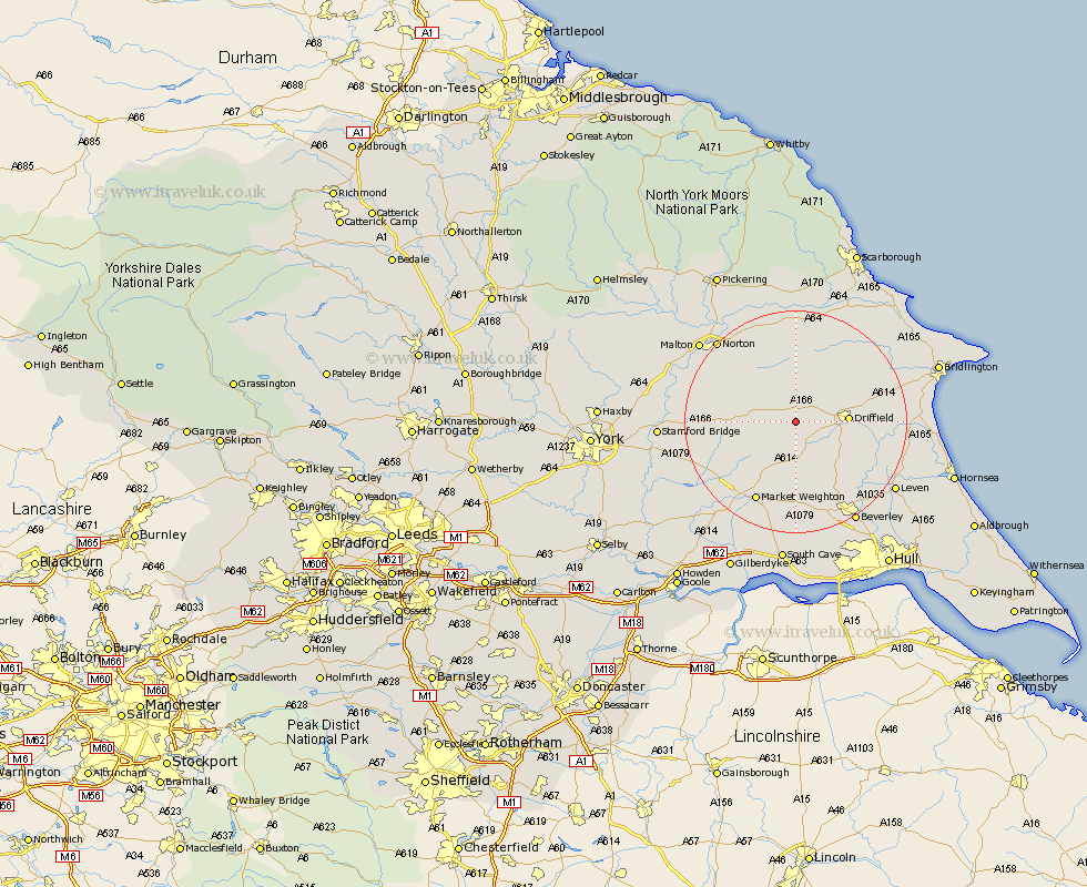
Yorkshire Map Showing Location of Wetwang
Population: 672
Easting: 493942 Northing: 456968
Latitude: 54 Longitude: -0.57
 = Wetwang
Easting: 493942 Northing: 456968
Latitude: 54 Longitude: -0.57
= Wetwang
This Wetwang map below is supplied by Google. Use the tools in the top left corner to zoom into street level or zoom out for a road map, you may also need to zoom in to see Wetwang on the map. Click and drag the map to move around. If the map fails to load try and refresh your browser or zoom in or out (+ or -).
Update - it seems Google no longer allow people to use their maps for free! This Wetwang map sometimes loads and sometimes gives a error. I am working on a solution.
Closest 30 Towns or Cities to Wetwang (Population over 500)
Wetwang 0km North Frodingham 6.59km Driffield 8.75km Cranswick 10.34km Nafferton 12.12km Lockington 12.38km Pocklington 14.1km Great Driffield 14.12km Kilham 14.2km Cherry Burton 15.45km Market Weighton 16.2km Leconfield 16.67km Leckonfield 16.67km Fangfoss 17.82km Barmby 17.96km Barmby-on-the-Moor 17.96km Barmby on the Moor 17.96km Rillington 18.81km Sherburn 18.82km Bishop Burton 19.04km Tickton 19.07km Brandsburton 19.75km Brandesburton 19.75km Beeford 19.96km Norton 20.03km Leven 20.88km Beverley 20.98km Dunnington 21.44km Wilberfoss 21.44km Malton 21.72km