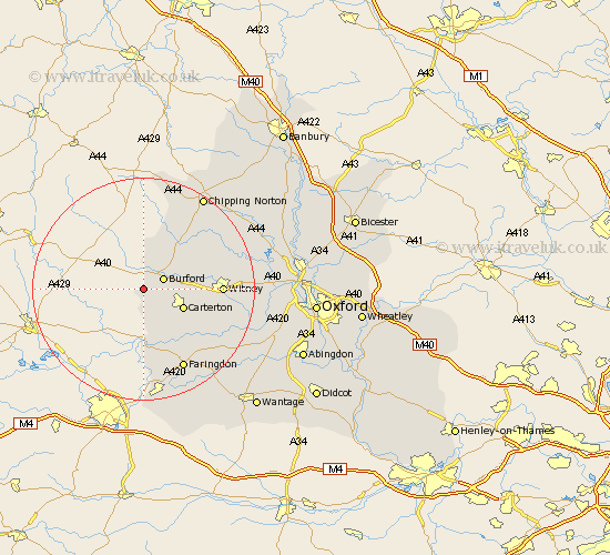
Oxfordshire Map Showing Location of Westwell
Population: 67
District: West Oxfordshire
Easting: 421842 Northing: 209501
Latitude: 51.78 Longitude: -1.68
 = Westwell
District: West Oxfordshire
Easting: 421842 Northing: 209501
Latitude: 51.78 Longitude: -1.68
= Westwell
This Westwell map below is supplied by Google. Use the tools in the top left corner to zoom into street level or zoom out for a road map, you may also need to zoom in to see Westwell on the map. Click and drag the map to move around. If the map fails to load try and refresh your browser or zoom in or out (+ or -).
Update - it seems Google no longer allow people to use their maps for free! This Westwell map sometimes loads and sometimes gives a error. I am working on a solution.
Closest 30 Towns or Cities to Westwell (Population over 500)
Burford 3.91km Shilton 6.02km Carterton 7.81km Brize Norton 8.24km Shipton-under-Wychwood 10.11km Shipton 10.11km Shipton under Wychwood 10.11km Minster Lovell 10.48km Leafield 10.96km Clanfield 11.54km Bampton 12.71km Witney 13.76km Kingham 13.76km Hailey 13.88km Ducklington 14.25km Churchill 14.68km Chadlington 15.96km Faringdon 16.35km North Leigh 17.29km Charlbury 17.54km Stonesfield 18.06km Buckland 18.1km Standlake 19.79km Chipping Norton 19.93km Stanton Harcourt 20.28km Longworth 20.5km Shrivenham 20.51km Watchfield 20.67km Church Handborough 20.72km Hanborough 20.72km