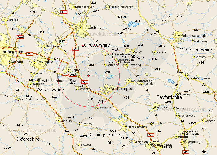
Northamptonshire Map Showing Location of West Haddon
Population: 1439
District: Daventry
Easting: 463589 Northing: 271032
Latitude: 52.33 Longitude: -1.07
 = West Haddon
District: Daventry
Easting: 463589 Northing: 271032
Latitude: 52.33 Longitude: -1.07
= West Haddon
This West Haddon map below is supplied by Google. Use the tools in the top left corner to zoom into street level or zoom out for a road map, you may also need to zoom in to see West Haddon on the map. Click and drag the map to move around. If the map fails to load try and refresh your browser or zoom in or out (+ or -).
Update - it seems Google no longer allow people to use their maps for free! This West Haddon map sometimes loads and sometimes gives a error. I am working on a solution.
Closest 30 Towns or Cities to West Haddon (Population over 500)
Long Buckby 3.7km Crick 4.53km Guilsborough 4.53km East Haddon 5.03km Yelvertoft 5.03km Kilsby 6.79km Naseby 7.93km Welton 7.94km Spratton 8.14km Barby 9.25km Welford 9.34km Braunston 10.63km Flore 11.17km Brixworth 11.48km Daventry 11.49km Clipston 12.2km Harpole 12.48km Boughton 12.62km Weedon Beck 12.97km Weedon 12.97km Pitsford 13km Kislingbury 14.64km Badby 15.2km Bugbrooke 15.21km Northampton 15.53km Moulton 15.74km Walgrave 16.99km Overstone 17.88km Pattishall 18.84km Great Billing 19.36km