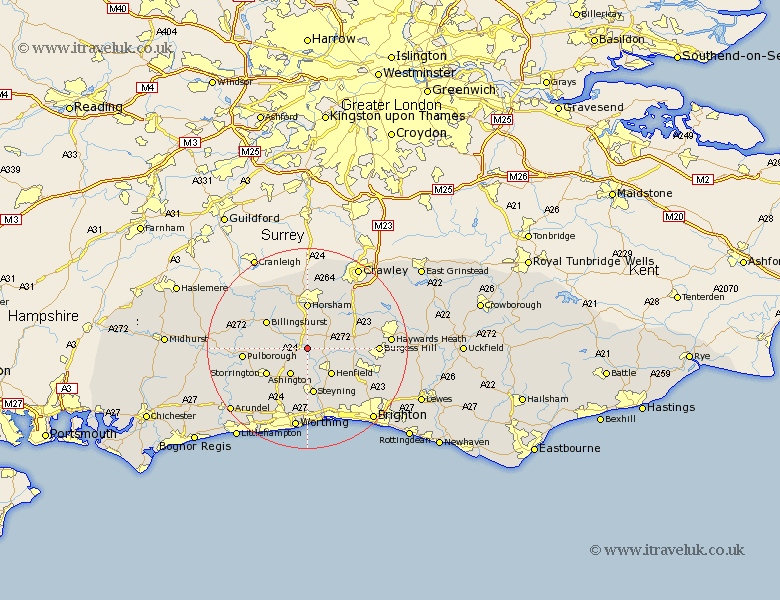
Sussex Map Showing Location of West Grinstead
Population: 2934
District: Horsham
Easting: 517018 Northing: 119969
Latitude: 50.97 Longitude: -0.33
 = West Grinstead
District: Horsham
Easting: 517018 Northing: 119969
Latitude: 50.97 Longitude: -0.33
= West Grinstead
This West Grinstead map below is supplied by Google. Use the tools in the top left corner to zoom into street level or zoom out for a road map, you may also need to zoom in to see West Grinstead on the map. Click and drag the map to move around. If the map fails to load try and refresh your browser or zoom in or out (+ or -).
Update - it seems Google no longer allow people to use their maps for free! This West Grinstead map sometimes loads and sometimes gives a error. I am working on a solution.
Closest 30 Towns or Cities to West Grinstead (Population over 500)
Shipley 2.33km Nuthurst 4.38km Cowfold 5.02km Southwater 5.68km Ashington 6.57km Thakeham 6.92km Henfield 7.26km Lower Beeding 8.06km Itchingfield 8.19km Washington 8.77km West Chiltington 8.98km West Chillington 8.98km Horsham 9.26km West Horsham 9.26km Steyning 9.34km Upper Beeding 9.35km Upper Bleeding 9.35km Bramber 9.35km Botney 9.52km Bolney 9.52km Storrington 9.8km Billingshurst 9.88km Slinfold 10.37km Albourne 11.14km Slaugham 11.91km Wisborough Green 12.92km Hurstpierpoint 12.93km Warnham 12.97km Pulborough 12.97km Findon 13.79km