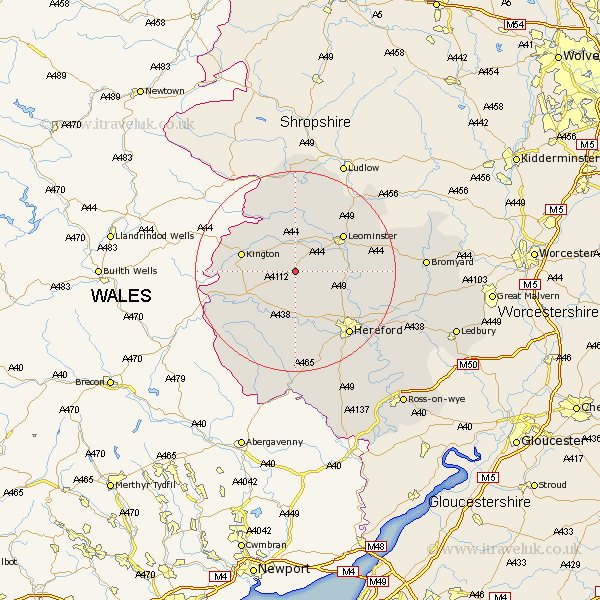
Herefordshire Map Showing Location of Weobley
Population: 1246
Easting: 340730 Northing: 252447
Latitude: 52.17 Longitude: -2.87
 = Weobley
Easting: 340730 Northing: 252447
Latitude: 52.17 Longitude: -2.87
= Weobley
This Weobley map below is supplied by Google. Use the tools in the top left corner to zoom into street level or zoom out for a road map, you may also need to zoom in to see Weobley on the map. Click and drag the map to move around. If the map fails to load try and refresh your browser or zoom in or out (+ or -).
Update - it seems Google no longer allow people to use their maps for free! This Weobley map sometimes loads and sometimes gives a error. I am working on a solution.
Closest 30 Towns or Cities to Weobley (Population over 500)
Dilwyn 1.85km Eardisland 5.67km Pembridge 6.01km Almeley 8.17km Credenhill 8.7km Lyonshall 8.77km Wellington 8.78km Shobdon 9.26km Eardisley 9.83km Burghill 10.08km Kingsland 10.32km Kington 10.88km Leominster 11.72km Moreton 11.74km Moreton on Lugg 11.74km Moreton-on-Lugg 11.74km Bodenham 12.64km Luston 13.67km Croft 13.74km Sutton 14.55km Madley 14.88km Peterchurch 15.89km Hereford 16.53km Wigmore 16.72km Orleton 16.82km Kingstone 16.83km Withington 17.57km Clifford 17.57km Allensmore 17.62km Bullingham 18.03km