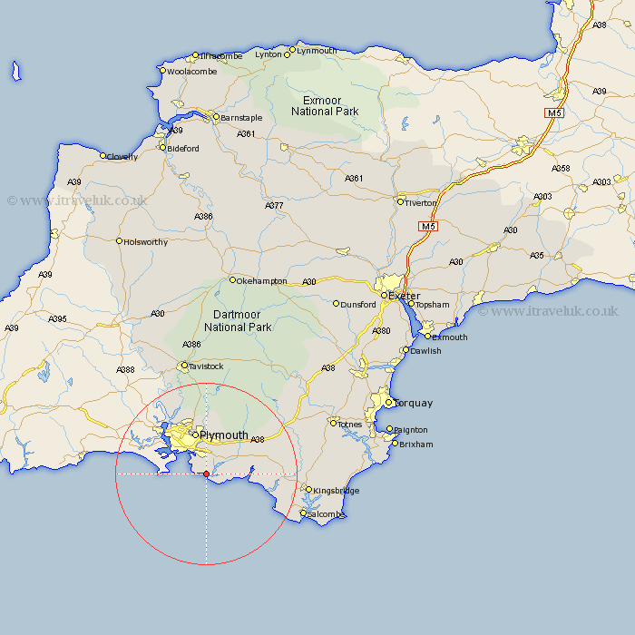
Devon Map Showing Location of Wembury
Population: 1065
Area Size (ha): 57
District: South Hams
Easting: 251697 Northing: 48450
Latitude: 50.32 Longitude: -4.08
 = Wembury
Area Size (ha): 57
District: South Hams
Easting: 251697 Northing: 48450
Latitude: 50.32 Longitude: -4.08
= Wembury
This Wembury map below is supplied by Google. Use the tools in the top left corner to zoom into street level or zoom out for a road map, you may also need to zoom in to see Wembury on the map. Click and drag the map to move around. If the map fails to load try and refresh your browser or zoom in or out (+ or -).
Update - it seems Google no longer allow people to use their maps for free! This Wembury map sometimes loads and sometimes gives a error. I am working on a solution.
Closest 30 Towns or Cities to Wembury (Population over 500)
Newton Ferrers 3.55km Brixton 5.13km Yealmpton 8.01km Plymouth 9.56km Holbeton 9.64km Ermington 13.07km Cornwood 13.86km Ivybridge 13.95km Modbury 14.67km Bickleigh 14.87km Shaugh Prior 15.01km Thurleston 16.36km Thurlestone 16.36km Aveton Gifford 17.85km Ugborough 18.14km Yelverton 18.53km Meavy 18.68km West Alvington 19.74km Horrabridge 20.42km Buckland Monachorum 20.69km Loddiswell 21.3km Brent 21.96km South Brent 21.96km Malborough 22.17km Walkhampton 22.27km Kingsbridge 22.8km Diptford 23.21km Salcombe 23.25km Whitechurch 24.34km Whitchurch 24.34km