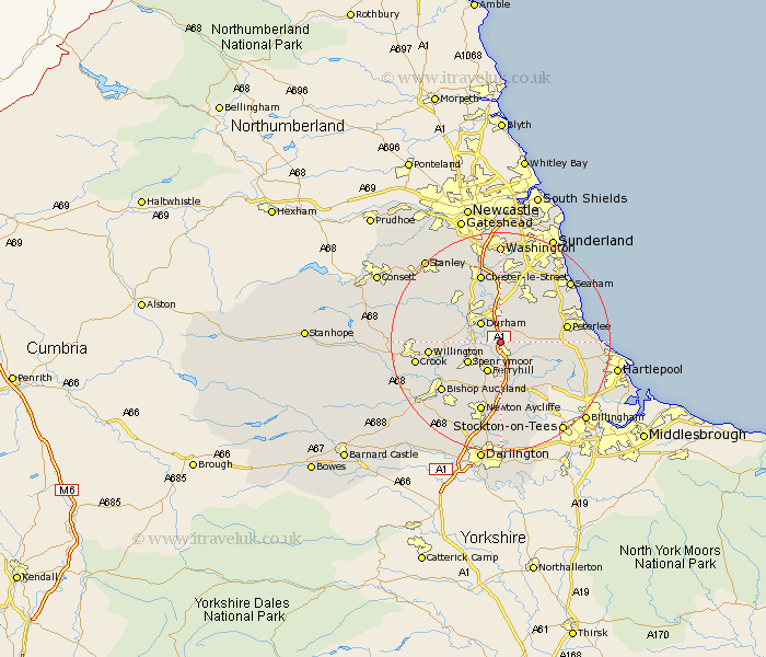
Durham Map Showing Location of Bowburn
Population: 3257
Area Size (ha): 81
District: Durham
Easting: 431119 Northing: 537713
Latitude: 54.73 Longitude: -1.52
 = Bowburn
Area Size (ha): 81
District: Durham
Easting: 431119 Northing: 537713
Latitude: 54.73 Longitude: -1.52
= Bowburn
This Bowburn map below is supplied by Google. Use the tools in the top left corner to zoom into street level or zoom out for a road map, you may also need to zoom in to see Bowburn on the map. Click and drag the map to move around. If the map fails to load try and refresh your browser or zoom in or out (+ or -).
Update - it seems Google no longer allow people to use their maps for free! This Bowburn map sometimes loads and sometimes gives a error. I am working on a solution.
Closest 30 Towns or Cities to Bowburn (Population over 500)
Coxhoe 2.14km West Cornforth 3.71km Cornforth 3.71km Shincliffe 3.86km Sherburn 4.28km Durham 4.91km Thornley 5.66km Ferryhill 5.96km Bishop Middleham 5.96km Spennymoor 6.55km Brandon 6.68km Trimdon 7.42km Pittington 7.72km Fishburn 7.72km Haswell 8.49km Wingate 8.56km West Rainton 9.33km Ushaw Moor 10.2km Hetton le Hole 10.21km Witton Gilbert 10.53km South Hetton 10.53km Sedgefield 10.7km Hutton Henry 10.86km Shotton 11.11km Murton 11.27km Sacriston 11.27km Peterlee 11.32km Coundon 11.33km Easington 11.64km Willington 11.92km