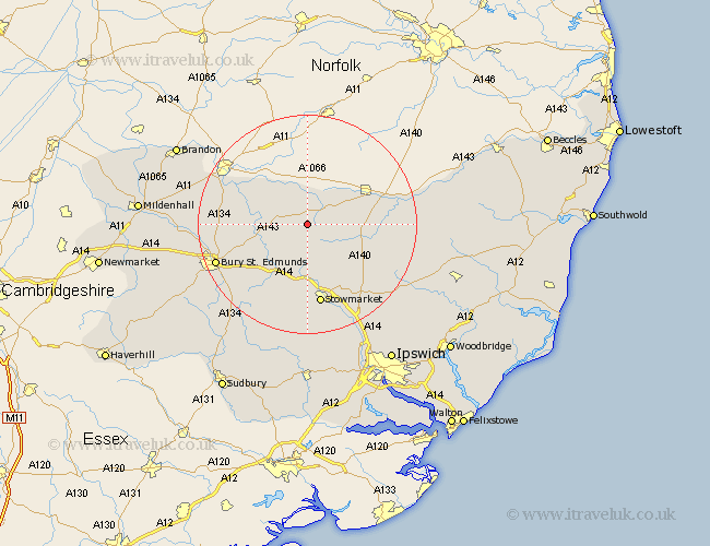
Suffolk Map Showing Location of Wattisfield
Population: 436
District: Mid Suffolk
Easting: 601045 Northing: 272873
Latitude: 52.32 Longitude: 0.95
 = Wattisfield
District: Mid Suffolk
Easting: 601045 Northing: 272873
Latitude: 52.32 Longitude: 0.95
= Wattisfield
This Wattisfield map below is supplied by Google. Use the tools in the top left corner to zoom into street level or zoom out for a road map, you may also need to zoom in to see Wattisfield on the map. Click and drag the map to move around. If the map fails to load try and refresh your browser or zoom in or out (+ or -).
Update - it seems Google no longer allow people to use their maps for free! This Wattisfield map sometimes loads and sometimes gives a error. I am working on a solution.
Closest 30 Towns or Cities to Wattisfield (Population over 500)
Hepworth 2.92km Stanton 3.4km Badwell Ash 4.35km Botesdale 4.89km Barningham 5.03km Hopton 5.67km Redgrave 6.52km Bardwell 6.8km Gislingham 7.05km Bacton 7.17km Wortham 7.74km Ixworth 8.15km Norton 9.34km Elmswell 9.55km Pakenham 9.69km Honington 10.36km Mendlesham 10.86km Troston 11.33km Haughley 11.35km Woolpit 11.63km Thurston 11.72km Old Newton 12.01km Thorndon 13.01km Eye 13.59km Great Barton 13.65km Stowmarket 15.01km Rattlesden 15.51km Barnham 15.73km Bradfield 16.51km Bradfield St. George 16.51km