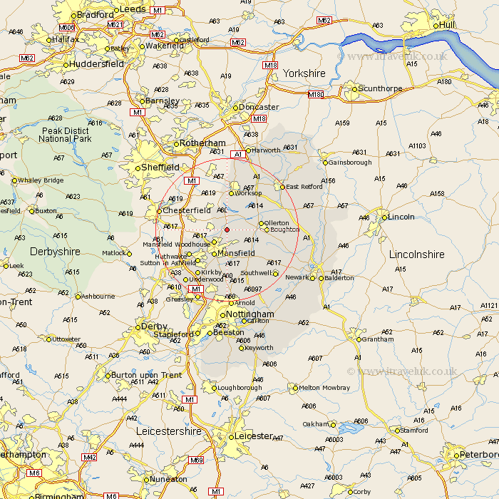
Nottinghamshire Map Showing Location of Warsop
Population: 9985
Area Size (ha): 205
District: Mansfield
Easting: 456773 Northing: 367360
Latitude: 53.2 Longitude: -1.15
 = Warsop
Area Size (ha): 205
District: Mansfield
Easting: 456773 Northing: 367360
Latitude: 53.2 Longitude: -1.15
= Warsop
This Warsop map below is supplied by Google. Use the tools in the top left corner to zoom into street level or zoom out for a road map, you may also need to zoom in to see Warsop on the map. Click and drag the map to move around. If the map fails to load try and refresh your browser or zoom in or out (+ or -).
Update - it seems Google no longer allow people to use their maps for free! This Warsop map sometimes loads and sometimes gives a error. I am working on a solution.
Closest 30 Towns or Cities to Warsop (Population over 500)
Clipstone 4.98km Mansfield Woodhouse 4.98km Edwinstowe 5.85km Pleasley 7.62km Mansfield 8.13km Ollerton 9.07km Rainworth 9.53km Boughton 10.44km Bilsthorpe 10.75km Worksop 11.17km Walesby 11.7km Sutton in Ashfield 12.1km Hucknall under Huthwaite 12.45km Huthwaite 12.45km Hucknall 12.45km Hucknall-under-Huthwaite 12.45km Blidworth 13.02km Shireoaks 13.02km Farnsfield 13.57km Elkesley 14.28km Elksley 14.28km Kirkby 15.13km Kirkby in Ashfield 15.13km Newstead 15.48km Papplewick 16.83km Oxton 17.58km Tuxford 17.86km Annesley 17.96km Southwell 18.43km Selston 18.53km