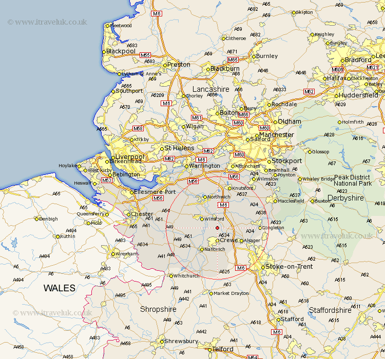
Cheshire Map Showing Location of Warmingham
Population: 175
District: Crewe and Nantwich
Easting: 371022 Northing: 361549
Latitude: 53.15 Longitude: -2.43
 = Warmingham
District: Crewe and Nantwich
Easting: 371022 Northing: 361549
Latitude: 53.15 Longitude: -2.43
= Warmingham
This Warmingham map below is supplied by Google. Use the tools in the top left corner to zoom into street level or zoom out for a road map, you may also need to zoom in to see Warmingham on the map. Click and drag the map to move around. If the map fails to load try and refresh your browser or zoom in or out (+ or -).
Update - it seems Google no longer allow people to use their maps for free! This Warmingham map sometimes loads and sometimes gives a error. I am working on a solution.
Closest 30 Towns or Cities to Warmingham (Population over 500)
Middlewich 3.7km Middlewick 3.7km Sandbach 4.82km Crewe 5.56km Winsford 6.68km Brereton 6.92km Brereton cum Smethwick 6.92km Holmes Chapel 7.12km Wistaston 7.74km Willaston 9.85km Alsager 10.49km Rode Heath 10.67km Whitegate 10.74km Davenham 10.8km Nantwich 10.8km Goostrey 11.41km Little Budworth 11.71km Hartford 12.09km Peover Superior 12.43km Peover 12.43km Wybunbury 13.02km Plumley Station 13.02km Plumbley 13.02km Lostock Gralam 13.16km Marston 13.71km Northwick 13.71km Northwich 13.71km Cuddington 14.46km Anderton 14.59km Bunbury 14.92km