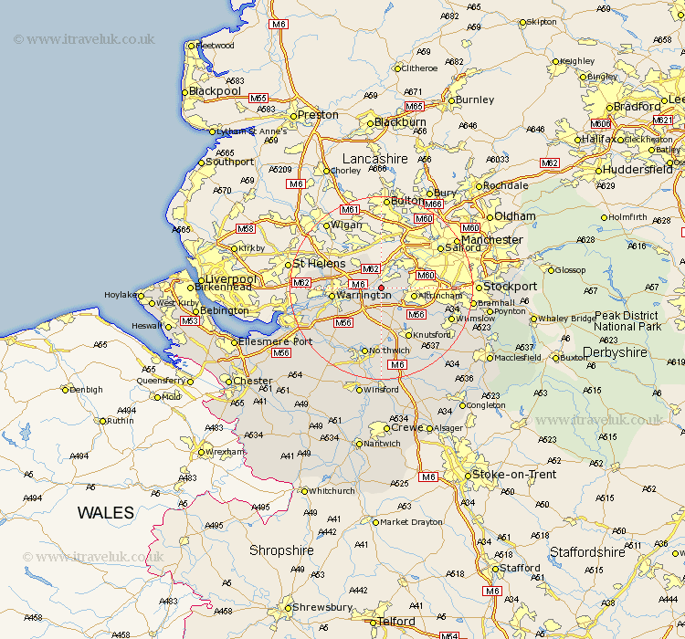
Cheshire Map Showing Location of Warburton
Population: 286
District: Trafford
Easting: 370083 Northing: 389364
Latitude: 53.4 Longitude: -2.45
 = Warburton
District: Trafford
Easting: 370083 Northing: 389364
Latitude: 53.4 Longitude: -2.45
= Warburton
This Warburton map below is supplied by Google. Use the tools in the top left corner to zoom into street level or zoom out for a road map, you may also need to zoom in to see Warburton on the map. Click and drag the map to move around. If the map fails to load try and refresh your browser or zoom in or out (+ or -).
Update - it seems Google no longer allow people to use their maps for free! This Warburton map sometimes loads and sometimes gives a error. I am working on a solution.
Closest 30 Towns or Cities to Warburton (Population over 500)
Partington 2.89km Lymm 3.86km Glazebrook 3.86km Stockton Heath 4.29km Risley 4.79km Thelwall 4.8km High Legh 5.56km Bowdon 6.65km Altrincham 6.89km Culcheth 7.1km Croft 7.59km Mere 7.74km Appleton 8.66km Sale 10.11km Warrington 10.12km Winwick 10.61km Stretton 10.72km Sankey 11.21km Great Sankey 11.21km Knutsford 12.42km Mobberley 12.81km Burtonwood 14.83km Lostock Gralam 14.86km Plumbley 14.99km Plumley Station 14.99km Marston 15.19km Northwick 15.19km Northwich 15.19km Cheadle 15.47km Anderton 15.82km