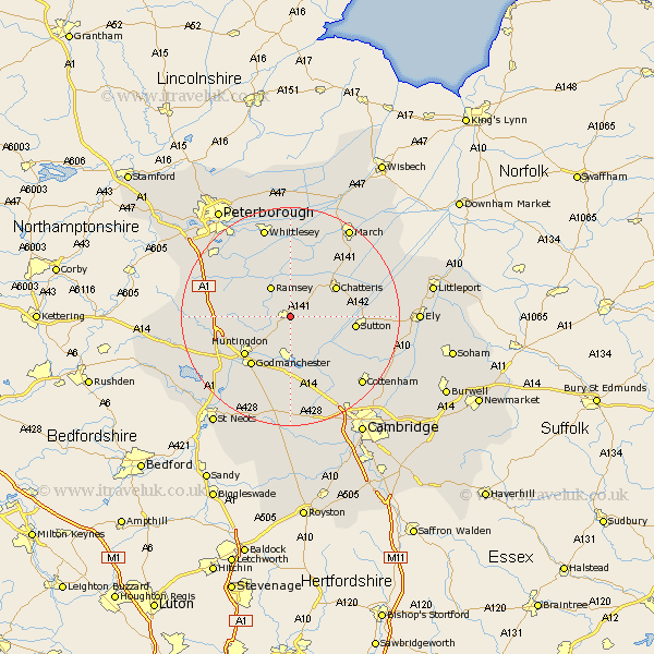
Cambridgeshire Map Showing Location of Warboys
Population: 2870
Area Size (ha): 91
District: Huntingdonshire
Easting: 531519 Northing: 279798
Latitude: 52.4 Longitude: -0.07
 = Warboys
Area Size (ha): 91
District: Huntingdonshire
Easting: 531519 Northing: 279798
Latitude: 52.4 Longitude: -0.07
= Warboys
This Warboys map below is supplied by Google. Use the tools in the top left corner to zoom into street level or zoom out for a road map, you may also need to zoom in to see Warboys on the map. Click and drag the map to move around. If the map fails to load try and refresh your browser or zoom in or out (+ or -).
Update - it seems Google no longer allow people to use their maps for free! This Warboys map sometimes loads and sometimes gives a error. I am working on a solution.
Closest 30 Towns or Cities to Warboys (Population over 500)
Wistow 2.26km Bury 2.93km Somersham 4.89km Ramsey 6.51km Colne 6.76km Bluntisham 7.93km Earith 7.93km Wyton 8.16km Hemingford Abbots 9.53km West Hemingford 9.53km Chatteris 9.67km Needingworth 9.87km Hemingford Grey 9.87km Hemingford 9.87km Huntingdon 10.85km Over 10.85km Saint Ives 11.12km Fen Stanton 11.12km St Ives 11.12km St. Ives 11.12km Sutton 11.46km Durolipons 11.49km Godmanchester 11.49km Swavesey 12.01km Mepal 12.44km Doddington 12.94km Willingham 12.95km Holme 13.52km Sawtry 14.06km Alconbury 14.07km