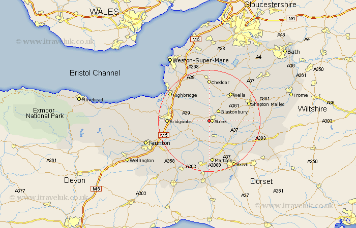
Somerset Map Showing Location of Walton
Population: 1170
District: Mendip
Easting: 346343 Northing: 135605
Latitude: 51.12 Longitude: -2.77
 = Walton
District: Mendip
Easting: 346343 Northing: 135605
Latitude: 51.12 Longitude: -2.77
= Walton
This Walton map below is supplied by Google. Use the tools in the top left corner to zoom into street level or zoom out for a road map, you may also need to zoom in to see Walton on the map. Click and drag the map to move around. If the map fails to load try and refresh your browser or zoom in or out (+ or -).
Update - it seems Google no longer allow people to use their maps for free! This Walton map sometimes loads and sometimes gives a error. I am working on a solution.
Closest 30 Towns or Cities to Walton (Population over 500)
Street 1.16km Ashcott 2.97km Compton 3.95km Shapwick 5km Glastonbury 5.36km Meare 5.68km Butleigh 6.11km High Ham 6.57km Somerton 7.51km Baltonsborough 8.14km Barton St. David 8.35km Barton Saint David 8.35km Barton St David 8.35km Charlton Mackrell 8.93km West Pennard 8.94km Othery 8.95km Middlezoy 9.49km Langport 10.38km Wookey 10.94km Cossington 11.1km Long Sutton 11.12km Weston Zoyland 11.63km Wedmore 11.65km Westbury 13.43km Wells 13.78km Curry Rivel 13.79km Pilton 13.95km Ilchester 14.22km Mark 14.49km Yeovilton 14.74km