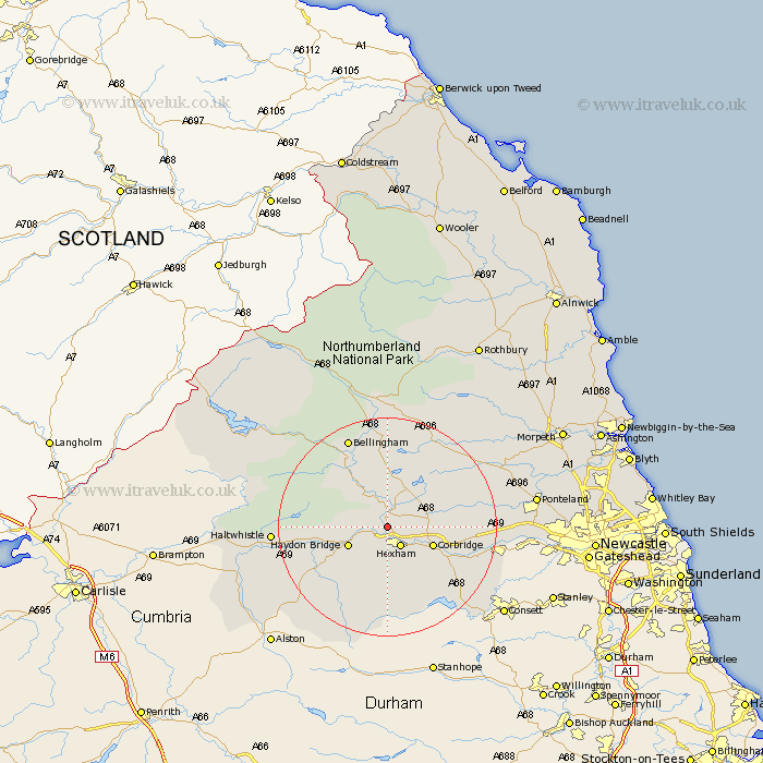
Northumberland Map Showing Location of Wall
Population: 420
District: Tynedale
Easting: 391471 Northing: 567285
Latitude: 55 Longitude: -2.13
 = Wall
District: Tynedale
Easting: 391471 Northing: 567285
Latitude: 55 Longitude: -2.13
= Wall
This Wall map below is supplied by Google. Use the tools in the top left corner to zoom into street level or zoom out for a road map, you may also need to zoom in to see Wall on the map. Click and drag the map to move around. If the map fails to load try and refresh your browser or zoom in or out (+ or -).
Update - it seems Google no longer allow people to use their maps for free! This Wall map sometimes loads and sometimes gives a error. I am working on a solution.
Closest 30 Towns or Cities to Wall (Population over 500)
Warden 1.86km Acomb 2.82km Newbrough 3.19km Humshaugh 3.7km Chollerton 4.27km Challerton 4.27km Hexham 4.27km Sandhoe 5.63km Haydon Bridge 7.38km Corbridge 8.31km Wark 9.12km Slaley 12.82km Ridingmill 12.97km Riding 12.97km Stocksfield 15.69km Stamfordham 17.4km Ovingham 17.41km Bellingham 17.85km Wylam 18.45km Prudhoe 18.92km Haltwhistle 19.23km Otterburn 24.19km Ponteland 25.06km Newburn 25.79km Woolsington 28.75km Dinnington 29.22km Stannington 31.74km Gosforth 32.95km Morpeth 34.12km Newcastle on Tyne 34.23km