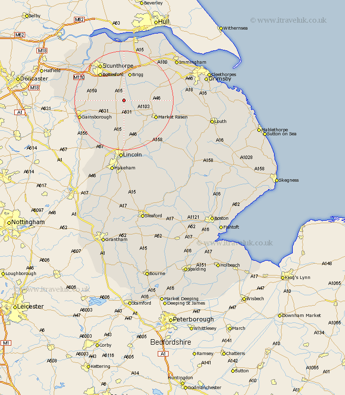
Lincolnshire Map Showing Location of Waddingham
Population: 548
District: West Lindsey
Easting: 498496 Northing: 395856
Latitude: 53.45 Longitude: -0.52
 = Waddingham
District: West Lindsey
Easting: 498496 Northing: 395856
Latitude: 53.45 Longitude: -0.52
= Waddingham
This Waddingham map below is supplied by Google. Use the tools in the top left corner to zoom into street level or zoom out for a road map, you may also need to zoom in to see Waddingham on the map. Click and drag the map to move around. If the map fails to load try and refresh your browser or zoom in or out (+ or -).
Update - it seems Google no longer allow people to use their maps for free! This Waddingham map sometimes loads and sometimes gives a error. I am working on a solution.
Closest 30 Towns or Cities to Waddingham (Population over 500)
Hibaldstow 5.67km South Kelsey 5.82km Kirton in Lindsey 5.82km Kirton 5.82km North Kelsey 7.58km Scotton 9.02km Scawby 9.33km Scotter 10.6km Brigg 11.34km Middle Rasen 12.4km Messingham 12.79km Broughton 13.16km Blyton 13.38km Wrawby 13.39km Ingham 13.71km Caistor 13.75km Nettleton 13.75km Bottesford 14.19km Market Rasen 14.23km Barnetby 15.1km Barnetby le Wold 15.1km Willingham 15.68km Welton 16.82km Owston Ferry 16.96km Owston 16.96km Dunholme 17km Dunholm 17km Scrampton 17.01km Scampton 17.01km Scunthorpe 17.25km