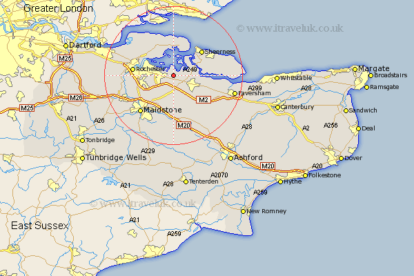
Kent Map Showing Location of Upchurch
Population: 2398
District: Swale
Easting: 584447 Northing: 166459
Latitude: 51.37 Longitude: 0.65
 = Upchurch
District: Swale
Easting: 584447 Northing: 166459
Latitude: 51.37 Longitude: 0.65
= Upchurch
This Upchurch map below is supplied by Google. Use the tools in the top left corner to zoom into street level or zoom out for a road map, you may also need to zoom in to see Upchurch on the map. Click and drag the map to move around. If the map fails to load try and refresh your browser or zoom in or out (+ or -).
Update - it seems Google no longer allow people to use their maps for free! This Upchurch map sometimes loads and sometimes gives a error. I am working on a solution.
Closest 30 Towns or Cities to Upchurch (Population over 500)
Lower Halstow 1.16km Newington 2.19km Bobbing 3.94km Stockbury 5.56km Iwade 5.78km Gillingham 6.11km Borden 6.56km Hoo 6.87km Tunstall 7.24km Stoke 7.76km Sittingbourne 7.88km Bredgar 8.19km Chatham 9.44km Queenborough 9.82km Bapchild 9.83km High Halstow 10.15km Grain 10.35km Detling 10.37km Strood 10.57km Sheerness 10.97km Allhallows 11.12km Rochester 11.49km Boxley 11.59km Linsted 11.87km Lynsted 11.87km Teynham 12.16km Bearsted 12.54km Minster 12.83km Burham 12.84km Hollingbourne 12.98km