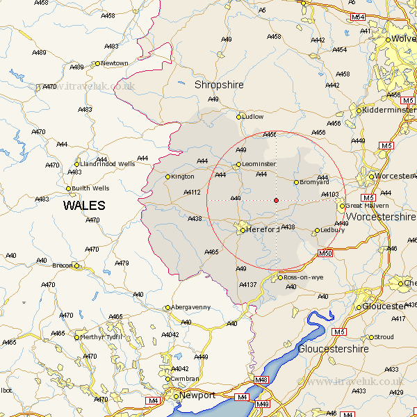
Herefordshire Map Showing Location of Ullingswick
Population: 252
Easting: 360077 Northing: 248539
Latitude: 52.13 Longitude: -2.58
 = Ullingswick
Easting: 360077 Northing: 248539
Latitude: 52.13 Longitude: -2.58
= Ullingswick
This Ullingswick map below is supplied by Google. Use the tools in the top left corner to zoom into street level or zoom out for a road map, you may also need to zoom in to see Ullingswick on the map. Click and drag the map to move around. If the map fails to load try and refresh your browser or zoom in or out (+ or -).
Update - it seems Google no longer allow people to use their maps for free! This Ullingswick map sometimes loads and sometimes gives a error. I am working on a solution.
Closest 30 Towns or Cities to Ullingswick (Population over 500)
Withington 5.04km Bodenham 7.07km Sutton 7.77km Bromyard 7.95km Lugwardine 8.69km Mordiford 9.87km Bosbury 10.67km Moreton 10.89km Moreton on Lugg 10.89km Moreton-on-Lugg 10.89km Wellington 11.38km Hereford 12.99km Burghill 13.05km Bullingham 14.38km Ledbury 14.68km Colwall 14.75km Fownhope 14.87km Leominster 15.11km Credenhill 15.25km Whitbourne 15.57km Much Marcle 15.88km Cradley 16.52km Luston 18.68km Allensmore 18.84km Kingsland 19.66km Weobley 19.69km Dilwyn 20.11km Brimfield 20.17km Much Dewchurch 20.2km Eardisland 20.41km