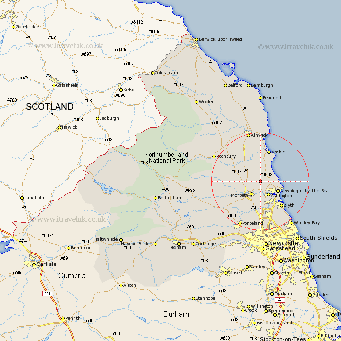
Northumberland Map Showing Location of Ulgham
Population: 365
District: Castle Morpeth
Easting: 423326 Northing: 591451
Latitude: 55.22 Longitude: -1.63
 = Ulgham
District: Castle Morpeth
Easting: 423326 Northing: 591451
Latitude: 55.22 Longitude: -1.63
= Ulgham
This Ulgham map below is supplied by Google. Use the tools in the top left corner to zoom into street level or zoom out for a road map, you may also need to zoom in to see Ulgham on the map. Click and drag the map to move around. If the map fails to load try and refresh your browser or zoom in or out (+ or -).
Update - it seems Google no longer allow people to use their maps for free! This Ulgham map sometimes loads and sometimes gives a error. I am working on a solution.
Closest 30 Towns or Cities to Ulgham (Population over 500)
Ellington 4.23km Hebron 4.88km Pegswood 5.56km Lynemouth 5.78km Morpeth 6.4km Ashington 6.58km Hepscott 7.49km Newbiggin-by-the-Sea 7.73km Newbiggin by the Sea 7.73km East Chevington 8.05km East Thirston 8.06km Thirston 8.06km Felton 8.53km Longhorsley 8.66km Bedlington 9.84km Swarland 11.22km Longframlington 12.05km Blythe 13.09km Blyth 13.09km Stannington 13.15km Amble 13.35km Warkworth 14.86km Dudley 15.67km Shilbottle 16.98km Cramlington 16.98km Seaton Sluice 17.27km Seaton Delaval 18.25km Lisburg 18.55km Lesbury 18.55km Dinnington 18.81km