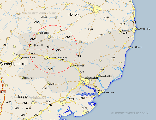
Suffolk Map Showing Location of Troston
Population: 851
District: St. Edmundsbury
Easting: 589688 Northing: 272423
Latitude: 52.32 Longitude: 0.78
 = Troston
District: St. Edmundsbury
Easting: 589688 Northing: 272423
Latitude: 52.32 Longitude: 0.78
= Troston
This Troston map below is supplied by Google. Use the tools in the top left corner to zoom into street level or zoom out for a road map, you may also need to zoom in to see Troston on the map. Click and drag the map to move around. If the map fails to load try and refresh your browser or zoom in or out (+ or -).
Update - it seems Google no longer allow people to use their maps for free! This Troston map sometimes loads and sometimes gives a error. I am working on a solution.
Closest 30 Towns or Cities to Troston (Population over 500)
Troston 0km Honington 2.17km Ixworth 3.87km Bardwell 4.53km Great Barton 5.67km Barnham 6.51km Pakenham 6.52km Thurston 7.76km Stanton 7.93km Fornham All Saints 7.94km Bury St. Edmunds 8.69km Bury St Edmunds 8.69km Bury Saint Edmunds 8.69km Barningham 8.75km Hepworth 9.25km Norton 9.33km Badwell Ash 9.8km Rushbrooke 11.18km Hopton 11.61km Risby 11.62km Elmswell 12.97km Bradfield St. George 13.03km Bradfield St George 13.03km Bradfield 13.03km Bradfield Saint George 13.03km Woolpit 13.66km Redgrave 15.73km Botesdale 15.96km Rattlesden 16.32km Barrow 16.47km