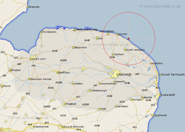
Norfolk Map Showing Location of Trimingham
Population: 370
District: North Norfolk
Easting: 629764 Northing: 339120
Latitude: 52.9 Longitude: 1.42
 = Trimingham
District: North Norfolk
Easting: 629764 Northing: 339120
Latitude: 52.9 Longitude: 1.42
= Trimingham
This Trimingham map below is supplied by Google. Use the tools in the top left corner to zoom into street level or zoom out for a road map, you may also need to zoom in to see Trimingham on the map. Click and drag the map to move around. If the map fails to load try and refresh your browser or zoom in or out (+ or -).
Update - it seems Google no longer allow people to use their maps for free! This Trimingham map sometimes loads and sometimes gives a error. I am working on a solution.
Closest 30 Towns or Cities to Trimingham (Population over 500)
Mundesley 3.7km Mundersley 3.7km Overstrand 4.84km Northrepps 5.59km Trunch 5.67km Bacton 6.49km Roughton 8.04km Cromer 8.65km Walcott 9.29km North Walsham 9.53km West Runton 11.77km Runton 11.77km Felmingham 12.45km Worstead 13.02km Erpingham 13.42km Happisburgh 13.68km Smallburgh 14.99km Sheringham 14.99km Stalham 16.27km Aylsham 17.14km Little Hautbois 17.6km Lammas 17.6km Lamas Little Hautbois 17.6km Weybourne 18.26km Sutton 18.43km Marsham 18.58km Beeston Saint Lawrence 18.67km Beeston St Lawrence 18.67km Beeston 18.67km Beeston St. Lawrence 18.67km