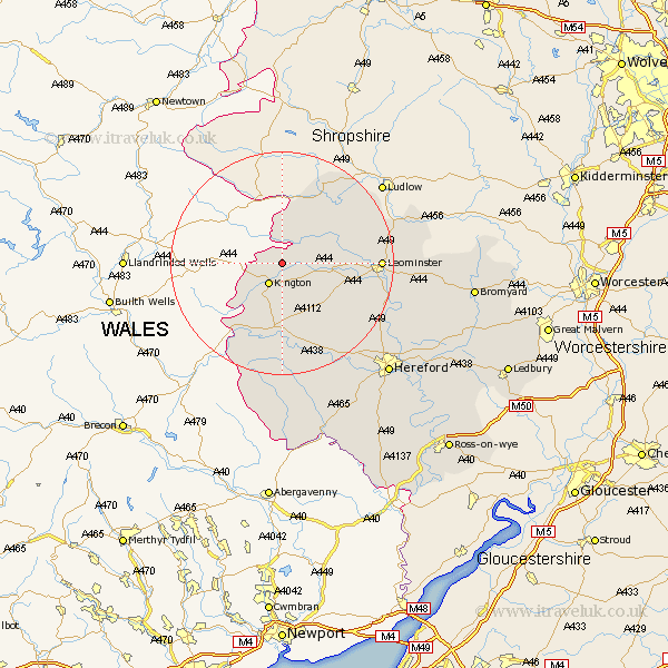
Herefordshire Map Showing Location of Titley
Population: 167
Easting: 332852 Northing: 259955
Latitude: 52.23 Longitude: -2.98
 = Titley
Easting: 332852 Northing: 259955
Latitude: 52.23 Longitude: -2.98
= Titley
This Titley map below is supplied by Google. Use the tools in the top left corner to zoom into street level or zoom out for a road map, you may also need to zoom in to see Titley on the map. Click and drag the map to move around. If the map fails to load try and refresh your browser or zoom in or out (+ or -).
Update - it seems Google no longer allow people to use their maps for free! This Titley map sometimes loads and sometimes gives a error. I am working on a solution.
Closest 30 Towns or Cities to Titley (Population over 500)
Lyonshall 3.7km Kington 4.34km Pembridge 5.97km Shobdon 8.16km Almeley 9.26km Eardisland 9.27km Dilwyn 9.7km Weobley 10.87km Eardisley 11.18km Kingsland 12.62km Wigmore 12.97km Croft 13.66km Luston 16.31km Leintwardine 16.82km Clifford 16.82km Leominster 17.03km Orleton 17.53km Credenhill 19.39km Wellington 19.41km Brimfield 20.66km Burghill 20.93km Peterchurch 22.35km Bodenham 22.45km Moreton 22.59km Moreton on Lugg 22.59km Moreton-on-Lugg 22.59km Madley 24.03km Sutton 25.27km Kingstone 26.17km Hereford 27.32km