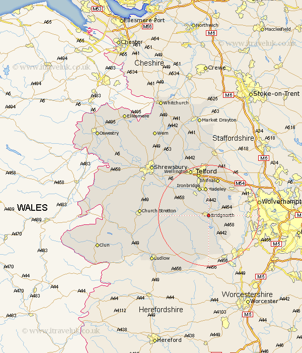
Shropshire Map Showing Location of Bridgnorth
Population: 11031
Area Size (ha): 309
District: Bridgnorth
Easting: 371739 Northing: 292947
Latitude: 52.53 Longitude: -2.42
 = Bridgnorth
Area Size (ha): 309
District: Bridgnorth
Easting: 371739 Northing: 292947
Latitude: 52.53 Longitude: -2.42
= Bridgnorth
This Bridgnorth map below is supplied by Google. Use the tools in the top left corner to zoom into street level or zoom out for a road map, you may also need to zoom in to see Bridgnorth on the map. Click and drag the map to move around. If the map fails to load try and refresh your browser or zoom in or out (+ or -).
Update - it seems Google no longer allow people to use their maps for free! This Bridgnorth map sometimes loads and sometimes gives a error. I am working on a solution.
Closest 30 Towns or Cities to Bridgnorth (Population over 500)
Worfield 3.86km Claverley 7.89km Barrow 8.15km Barrow Bridge 8.15km Highley 9.53km Alveley 10.3km Broseley 10.31km Ditton Priors 10.8km Madeley 11.18km Ironbridge 11.62km Much Wenlock 11.67km Kinlet 12.96km Albrighton 15.05km Shifnal 15.21km Dawley 15.21km Cleobury Mortimer 17.28km Telford 17.45km Cressage 17.5km Oakengates 18.57km Hadley 19.08km Ketley 19.08km Wellington 19.73km Rushbury 20.38km Donnington 20.42km Downington 20.42km Trench 20.67km Wrockwardine 21.12km Diddlebury 21.62km Bitterley 21.67km Lilleshall 22.27km