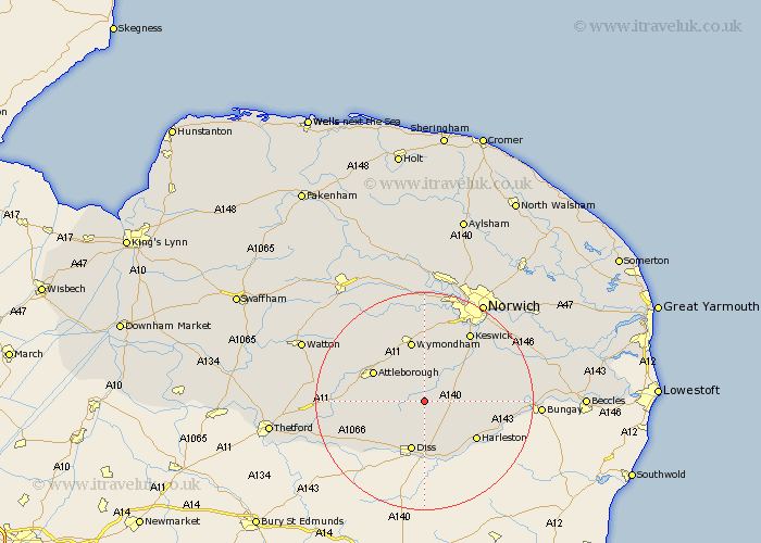
Norfolk Map Showing Location of Tibenham
Population: 453
District: South Norfolk
Easting: 613944 Northing: 290124
Latitude: 52.47 Longitude: 1.15
 = Tibenham
District: South Norfolk
Easting: 613944 Northing: 290124
Latitude: 52.47 Longitude: 1.15
= Tibenham
This Tibenham map below is supplied by Google. Use the tools in the top left corner to zoom into street level or zoom out for a road map, you may also need to zoom in to see Tibenham on the map. Click and drag the map to move around. If the map fails to load try and refresh your browser or zoom in or out (+ or -).
Update - it seems Google no longer allow people to use their maps for free! This Tibenham map sometimes loads and sometimes gives a error. I am working on a solution.
Closest 30 Towns or Cities to Tibenham (Population over 500)
Bunwell 2.16km Moulton Saint Michael 2.26km Great Moulton 2.26km Moulton St Michael 2.26km Moulton St. Michael 2.26km Moulton 2.26km Forncett St. Mary 5.02km Forncett 5.02km Forncett Saint Mary 5.02km Forncett St Mary 5.02km Long Stratton 5.94km Old Buckenham 7.02km Burston 7.42km Ashwellthorpe 7.74km Banham 8.12km Pulham 8.77km Diss 9.54km Besthorpe 9.66km Attleborough 10.6km Hempnall 10.81km Saxlingham 10.83km Saxlingham Thorpe 10.83km Mulbarton 10.84km Scole 11.18km Wymondham 11.35km Quidenham 11.44km Roydon 11.63km Harleston 11.69km Kenninghall 11.89km Bressingham 12.19km