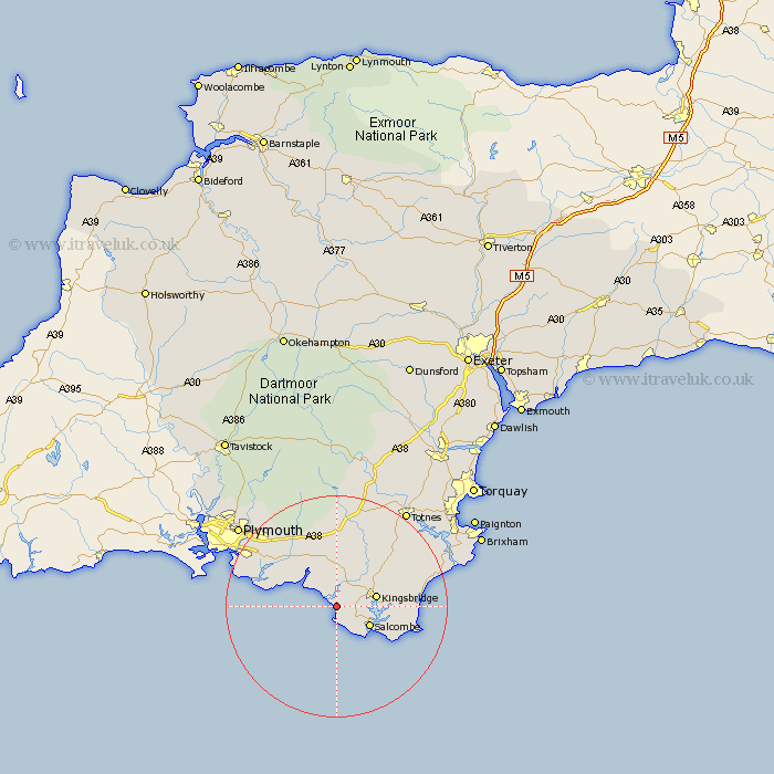
Devon Map Showing Location of Thurlestone
Population: 821
District: South Hams
Easting: 266979 Northing: 42483
Latitude: 50.27 Longitude: -3.87
 = Thurlestone
District: South Hams
Easting: 266979 Northing: 42483
Latitude: 50.27 Longitude: -3.87
= Thurlestone
This Thurlestone map below is supplied by Google. Use the tools in the top left corner to zoom into street level or zoom out for a road map, you may also need to zoom in to see Thurlestone on the map. Click and drag the map to move around. If the map fails to load try and refresh your browser or zoom in or out (+ or -).
Update - it seems Google no longer allow people to use their maps for free! This Thurlestone map sometimes loads and sometimes gives a error. I am working on a solution.
Closest 30 Towns or Cities to Thurlestone (Population over 500)
West Alvington 3.55km Aveton Gifford 4.4km Malborough 6.02km Salcombe 6.99km Kingsbridge 7.34km Loddiswell 8.12km Modbury 9.34km Holbeton 9.48km East Allington 10.98km Ermington 11.67km Yealmpton 12.43km Ugborough 13.02km Newton Ferrers 13.08km Ivybridge 13.45km Stokenham 14.22km Brixton 15.03km Diptford 15.96km Wembury 16.36km Blackawton 16.96km Strete 17.48km Street 17.48km Cornwood 18.13km South Brent 18.68km Brent 18.68km Stoke Fleming 19.74km Harberton 19.79km Totnes 21.61km Dartmouth 22.15km Stoke Gabriel 23.12km Plymouth 23.12km