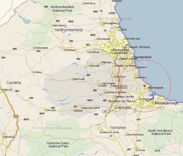
Durham Map Showing Location of High Throston
Easting: 448328 Northing: 534155
Latitude: 54.7 Longitude: -1.25
 = High Throston
Latitude: 54.7 Longitude: -1.25
= High Throston
This High Throston map below is supplied by Google. Use the tools in the top left corner to zoom into street level or zoom out for a road map, you may also need to zoom in to see High Throston on the map. Click and drag the map to move around. If the map fails to load try and refresh your browser or zoom in or out (+ or -).
Update - it seems Google no longer allow people to use their maps for free! This High Throston map sometimes loads and sometimes gives a error. I am working on a solution.
Closest 30 Towns or Cities to High Throston (Population over 500)
Hart 2.14km Hartlepool 2.83km Elwick 2.83km Horden 5.96km Hutton Henry 6.69km Hesleden 7.02km Greatham 7.49km Peterlee 9.33km Wingate 9.33km Wolviston 9.51km Trimdon 10.71km Billingham on Tees 11.58km Billingham 11.58km Billingham-on-Tees 11.58km Easington 11.79km Shotton 11.91km Fishburn 11.93km Grindon 12.62km Thornley 13.02km Sedgefield 13.03km Haswell 14.15km Stockton-on-Tees 14.68km Stockton on Tees 14.68km Stockton 14.68km South Hetton 14.71km Dalton le Dale 14.98km Dalton 14.98km Bishop Middleham 15.11km Coxhoe 16.17km Carlton 16.17km