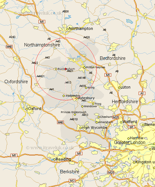
Buckinghamshire Map Showing Location of Thornton
Population: 160
District: Aylesbury Vale
Easting: 475507 Northing: 234124
Latitude: 52 Longitude: -0.9
 = Thornton
District: Aylesbury Vale
Easting: 475507 Northing: 234124
Latitude: 52 Longitude: -0.9
= Thornton
This Thornton map below is supplied by Google. Use the tools in the top left corner to zoom into street level or zoom out for a road map, you may also need to zoom in to see Thornton on the map. Click and drag the map to move around. If the map fails to load try and refresh your browser or zoom in or out (+ or -).
Update - it seems Google no longer allow people to use their maps for free! This Thornton map sometimes loads and sometimes gives a error. I am working on a solution.
Closest 30 Towns or Cities to Thornton (Population over 500)
Thornborough 2.18km Great Horwood 4.35km Maids Moreton 4.56km Padbury 5.04km Buckingham 5.7km Akeley 5.88km Winslow 6.01km Stony Stratford 6.53km Gawcott 7.79km Wolverton 7.96km Shenley Church End 8.2km Shenley 8.2km Stowe 8.2km Bradwell 8.8km Shenley Brook End 9.13km Mursley 9.36km Steeple Claydon 9.36km Claydon 9.36km Newton Longville 9.85km Castlethorpe 10.32km Tingewick 10.44km Bletchley 11.56km Milton Keynes 11.69km Twyford 11.76km Hanslope 12.49km Great Linford 12.66km North Marston 13.18km Stoke Hammond 13.73km Whitechurch 13.76km Whitchurch 13.76km