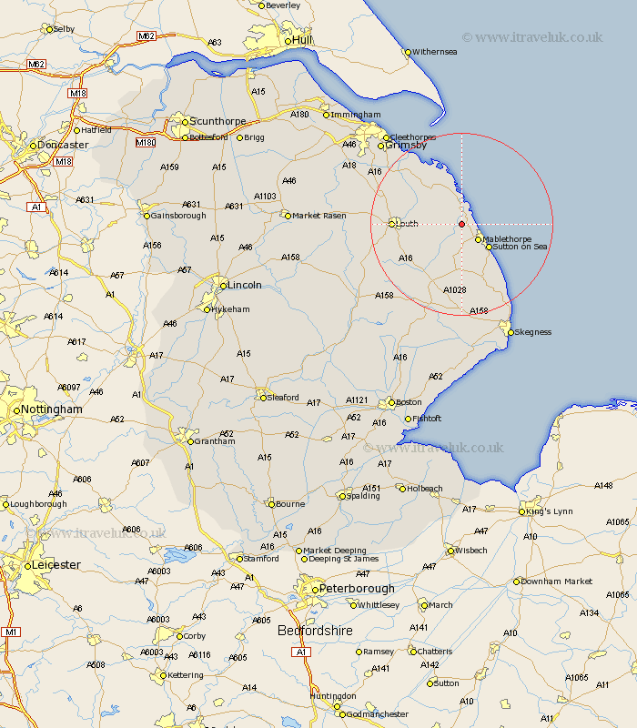
Lincolnshire Map Showing Location of Theddlethorpe All Saints
Population: 212
District: East Lindsey
Easting: 546364 Northing: 387821
Latitude: 53.37 Longitude: 0.2
 = Theddlethorpe All Saints
District: East Lindsey
Easting: 546364 Northing: 387821
Latitude: 53.37 Longitude: 0.2
= Theddlethorpe All Saints
This Theddlethorpe All Saints map below is supplied by Google. Use the tools in the top left corner to zoom into street level or zoom out for a road map, you may also need to zoom in to see Theddlethorpe All Saints on the map. Click and drag the map to move around. If the map fails to load try and refresh your browser or zoom in or out (+ or -).
Update - it seems Google no longer allow people to use their maps for free! This Theddlethorpe All Saints map sometimes loads and sometimes gives a error. I am working on a solution.
Closest 30 Towns or Cities to Theddlethorpe All Saints (Population over 500)
Saltfleetby St. Clement 3.86km Saltfleetby St Clement 3.86km Saltfleetby 3.86km Saltfleetby Saint Clement 3.86km Mablethorpe 4.98km Saltfleet 5.67km Manby 6.63km Grimoldby 7.74km Sutton on Sea 7.84km Sutton-on-Sea 7.84km North Somercotes 8.11km Legbourne 10.63km Alford 13.02km Grainthorpe 13.54km Huttoft 13.71km Louth 14.38km North Coates 15.67km Willoughby 16.68km Fulstow 17.09km Chapel St Leonards 18.39km Chapel Saint Leonards 18.39km Chapel St. Leonards 18.39km Tetney 19.34km North Thoresby 19.95km Spilsby 21.45km Ingoldmells 22.24km Humberston 24.12km Humberstone 24.12km Holton le Clay 24.29km Burgh le Marsh 24.32km