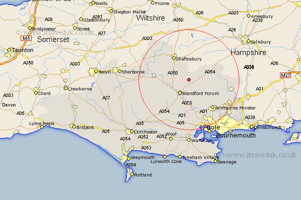
Dorset Map Showing Location of Tarrant Gunville
Population: 236
District: North Dorset
Easting: 391799 Northing: 113094
Latitude: 50.92 Longitude: -2.12
 = Tarrant Gunville
District: North Dorset
Easting: 391799 Northing: 113094
Latitude: 50.92 Longitude: -2.12
= Tarrant Gunville
This Tarrant Gunville map below is supplied by Google. Use the tools in the top left corner to zoom into street level or zoom out for a road map, you may also need to zoom in to see Tarrant Gunville on the map. Click and drag the map to move around. If the map fails to load try and refresh your browser or zoom in or out (+ or -).
Update - it seems Google no longer allow people to use their maps for free! This Tarrant Gunville map sometimes loads and sometimes gives a error. I am working on a solution.
Closest 30 Towns or Cities to Tarrant Gunville (Population over 500)
Pimperne 3.89km Iwerne Minster 5.02km Fontmell Magna 5.96km Tarrant Monkton 6.03km Blandford 6.57km Blandford Forum 6.57km Stourpaine 6.92km Charlton 7.5km Child Okeford 8.18km Handley 8.98km Shillingstone 9.53km Shaftesbury 10.95km Spetisbury 11.12km Sturminster Newton 11.68km Winterborne Stickland 12.37km Stickland Winterborne 12.37km Motcombe 13.14km Stour Provost 13.83km Horton 13.85km Cranborne 14.15km East Stour 14.9km Stour 14.9km Marnhull 15.08km Wimborne 15.11km Wimborne Minster 15.11km Sturminster Marshall 15.24km Whitechurch 15.34km Corfe Mullen 15.95km Gillingham 16.68km Milton Abbas 17.47km