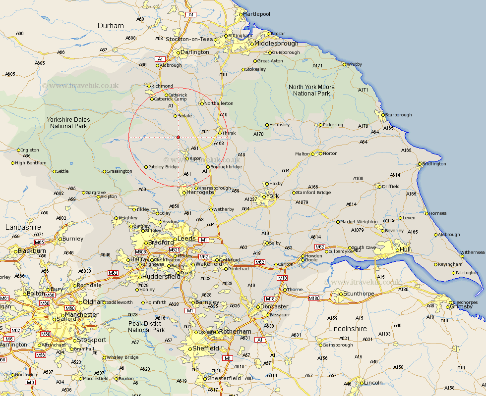
Yorkshire Map Showing Location of Tanfield
Population: 532
District: Hambleton
Easting: 428265 Northing: 478354
Latitude: 54.2 Longitude: -1.57
 = Tanfield
District: Hambleton
Easting: 428265 Northing: 478354
Latitude: 54.2 Longitude: -1.57
= Tanfield
This Tanfield map below is supplied by Google. Use the tools in the top left corner to zoom into street level or zoom out for a road map, you may also need to zoom in to see Tanfield on the map. Click and drag the map to move around. If the map fails to load try and refresh your browser or zoom in or out (+ or -).
Update - it seems Google no longer allow people to use their maps for free! This Tanfield map sometimes loads and sometimes gives a error. I am working on a solution.
Closest 30 Towns or Cities to Tanfield (Population over 500)
Masham 5.73km Grewelthorpe 5.73km Kirkby Malzeard 6.57km Bedale 9.33km Ripon 9.82km Dishforth 11.23km Crakehall 11.58km Topcliffe 12.07km Bishop Monkton 13.68km Monkton 13.68km Thirsk 15.29km Burton Leonard 15.45km Boroughbridge 16.92km Northallerton 17.17km Bewerley 18.39km Middleham 18.7km Birstwith 18.82km Catterick 19.03km Brompton 19.31km Dacre 19.33km Leyburn 19.68km Marton le Moor 19.73km Marton 19.73km Killinghall 20.41km Darley 20.47km Scorton 20.5km Hampsthwaite 20.5km Raskelf 21.91km North Cowton 22.27km Knaresborough 23.17km