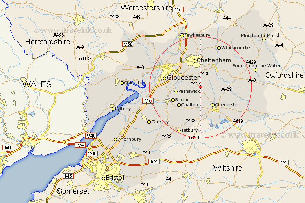
Gloucestershire Map Showing Location of Syde
Population: 30
District: Cotswold
Easting: 396552 Northing: 211312
Latitude: 51.8 Longitude: -2.05
 = Syde
District: Cotswold
Easting: 396552 Northing: 211312
Latitude: 51.8 Longitude: -2.05
= Syde
This Syde map below is supplied by Google. Use the tools in the top left corner to zoom into street level or zoom out for a road map, you may also need to zoom in to see Syde on the map. Click and drag the map to move around. If the map fails to load try and refresh your browser or zoom in or out (+ or -).
Update - it seems Google no longer allow people to use their maps for free! This Syde map sometimes loads and sometimes gives a error. I am working on a solution.
Closest 30 Towns or Cities to Syde (Population over 500)
North Cerney 6.82km Charlton Kings 7.51km Leckhampton 7.76km Withington 7.81km Shurdington 8.72km Cicester 8.72km Cirencester 8.72km Chedworth 9.17km Painswick 9.36km Brockworth 9.76km Andoversford 10.11km Hucclecote 10.72km Chalford 10.93km Cheltenham 11.35km Stroud 11.72km Churchdown 12.25km Minchinhampton 13.72km Innsworth 13.86km Gloucester 14.24km Randwick 14.25km Siddington 14.69km Southam 14.82km Swindon 15.21km Staverton 15.25km Avening 15.26km Woodchester 15.65km Ampney St Peter 15.98km Ampney St. Peter 15.98km Ampney Saint Peter 15.98km Ampney 15.98km